The NWS has issued a Blizzard Warning for almost all of El Paso County, as well as a Winter Storm Warning for Teller County. The start time of this warning is going to be moved to 10 am Wednesday morning, as that is when conditions will start to deteriorate.
Schools are already making the call to cancel classes on Wednesday. For a current list of closures and delays click here.
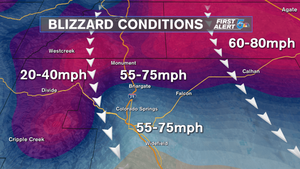
Strong winds accompanied with heavy, blowing snow will make any travel through El Paso County, especially north to Denver, dangerous from 10 am well into the overnight hours. Sustained wind speeds will blow between 50 to 60 mph with gusts to 75 mph possible, especially from the mid-afternoon to the early evening.
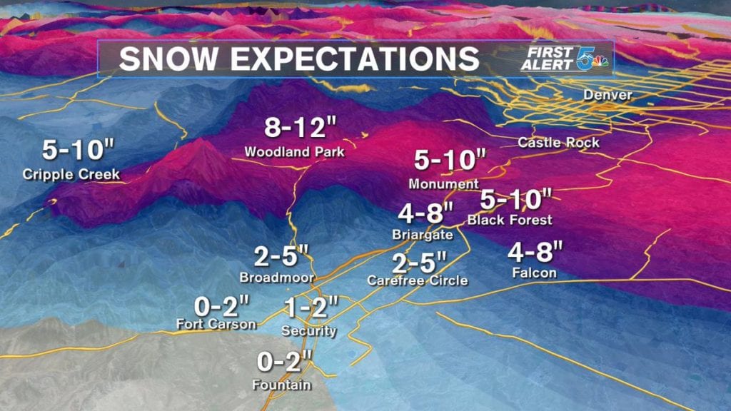
Snow totals will range WIDELY across the city, with the heaviest snow forecast to fall from Teller county up around and over Monument Hill and then east across the Palmer Divide. The heaviest pockets of snow will actually fall northeast of our viewing area, up around northern Lincoln County, as well as Kit Carson, Washington and Yuma counties.
Strong winds but much lighter snow are expected across Pueblo, Las Animas and all other counties into the eastern plains. Snow totals across Pueblo county, including the city, will likely stay at or under 1 inch, but east towards Kiowa county, 1 to 3 inches is more likely. Travel could still be quite dangerous at times tomorrow, especially along and north of highway 50 east of Pueblo and El Paso counties through the evening hours.
