


A viewer recently sent our weather team an email about the term "Chinook winds." She said she grew up hearing the term, and it inspired her to learn more about where it came from. For those who don't know, let's take a look at the history of the term "Chinook winds."

These downslope winds go by many names worldwide. In the Alps, they're called Foehn winds for example. East of the Rockies, "Chinook" is a term used to describe warm, dry, and strong downslope winds coming off the mountains.

The name Chinook comes from a group of Native American tribes in the Pacific Northwest…who have long resided in an area that is today about a thirty-minute drive north of the city of Portland, Oregon.

Early settlers in this area experienced warm winds coming in off the ocean, which they called Chinook winds.

As western settlers arrived in Colorado and other states east of the Rockies...they sometimes encountered a dry warm wind east of the Rockies. These settlers adopted the same name for these winds. They were nicknamed snow eaters…as a strong Chinook wind could melt a foot of snow in a day.

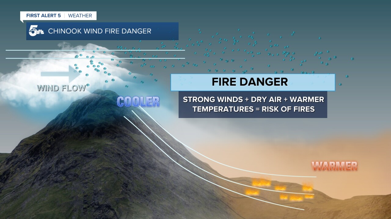
Chinook winds occur when high pressure is centered over the western U.S. and low pressure is to its north. Air gets squeezed between these systems and races into the Rockies producing clouds and precipitation.

With all its moisture wrung out, this air descends along the Front Range. As the air falls, it gets compressed…warms up…and dries out even more.
This results in large temperature increases…low humidity and strong wind gusts along the Front Range. These events quickly melt snow. And when our grasses...shrubs...and other plants are dry enough, they often lead to high fire danger.
Thanks, Karen, for sending us this thought-provoking email. Have a question or story idea you would like the First Alert 5 Weather team to consider? Email: weather@koaa.com
____
Watch KOAA News5 on your time, anytime with our free streaming app available for your Roku, FireTV, AppleTV and Android TV. Just search KOAA News5, download and start watching.
