A new storm is moving into Southern Colorado tonight, just days after a massive winter storm brought blizzard-like conditions to northern parts of El Paso County last weekend.
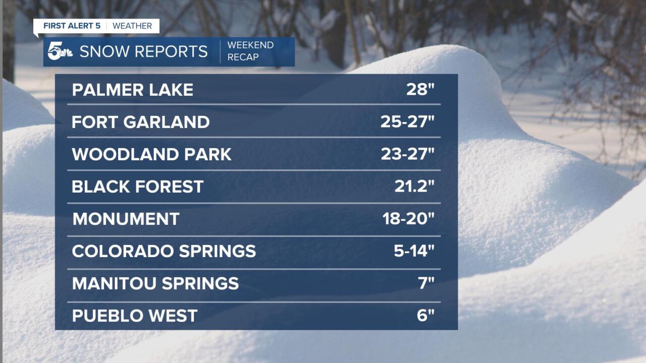
Monument and the Tri-Lakes were hit especially hard from last weekend's storm, with snowfall totals up over 2 feet in some areas.

Palmer Lake amassed a whopping 28" of snow from the storm, and experienced blizzard conditions nearly all day Sunday.
Many other areas in northern El Paso County and Teller County also came away with more than 20" of snowfall.
As advertised, Colorado Springs probably saw the biggest range in totals from the storm. Southern sections of town came away with about 5" of snowfall, while northern neighborhoods consistently reported more than a foot of snow.
Snow from the storm was heavy and wet, with rain seen in many areas before the snow pushed in.
This kind of snowfall is helpful for capturing water and helping with the drought, but not so good for your back when shoveling it away.

The Colorado Springs Airport collected 6.4" of snow, with a water equivalent of 0.59".
Pueblo reported 3.8" of snow and 0.49" of liquid precipitation.
For the year, both cities are above average. In the Springs, we've seen more than double the value of a normal year so far.

As you may have seen on News 5 this past weekend, the Denver area experienced the brunt of this storm.
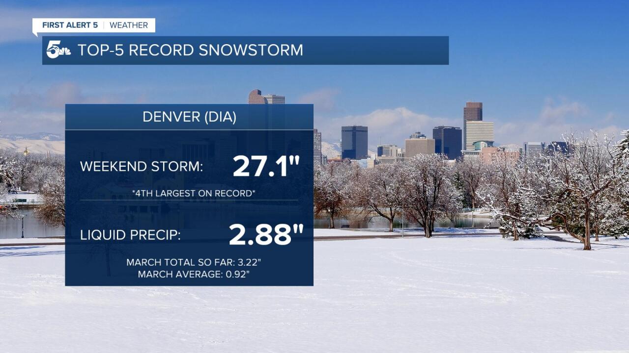
At the Denver Airport, the Blizzard of 2021 set daily snowfall records throughout the weekend, with 27.1" falling over two days.
It's now the fourth largest snowstorm on record at DIA.
Liquid precipitation this month in the Mile High has now surpassed three inches, and is more than three times the average with still two weeks to go in March.


