Snow has been hard to come by this month so far, but that's about to change as First Alert 5 is tracking an active period of weather for Southern Colorado.
With less than 1" of snow reported in February at the Colorado Springs Airport and Pueblo Airport, seasonal averages are now below the norm.
In Pueblo, we're now more than 52% behind where we should be at this point in the year.
By comparison, COS is in much better shape than Pueblo, only 5% below the average.

Blame it on a dry February, but the bottom line...we need more snow!
Thankfully spring can deliver the goods, with high content snowfall a plus from heavier snow events.
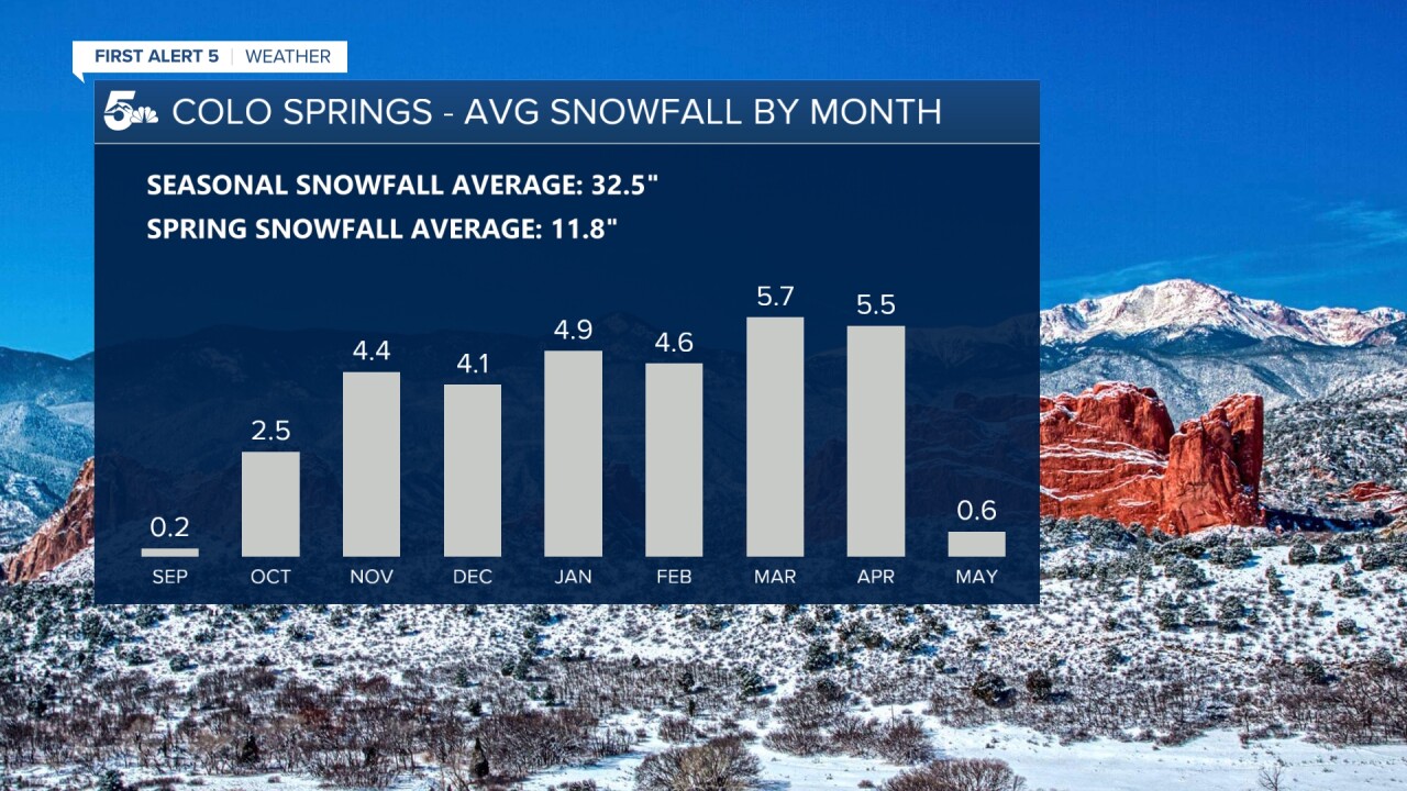
In Colorado Springs, spring-time snowfall accounts for more than 36% of our average.
In fact, March and April climatologically speaking are our snowiest.

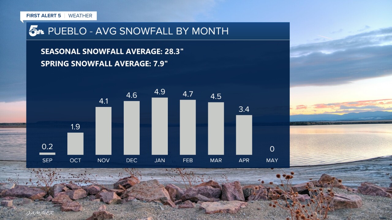
At the Pueblo Memorial Airport, we average around 8" of snow in the spring, which accounts for nearly 28% of our average.
March is on average the fourth snowiest month of the year, April the sixth snowiest for Pueblo.

Now to the forecast...a storm tonight likely won't do much for Colorado Springs and Pueblo, but the mid-week storm could be the start of an active period of weather.
The National Blend of Models is forecasting between 2.5" and 5" of snow from late Tuesday night into Wednesday evening for the Springs and Pueblo.
Looking out towards next week...there's the potential for another storm that could push 10 day storm totals up over 6".
That would put us above average for the month!
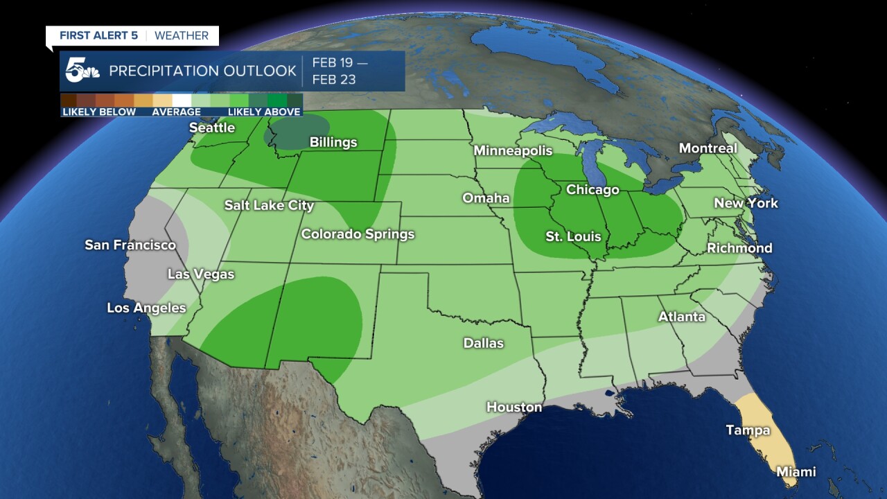
The Climate Prediction Center also likes our chances. This is their outlook for next week, and it shows the potential for snowier than average/wetter than average conditions across Southern Colorado.
This could be just the boost that we're looking for!

Stay tuned for the very latest from the First Alert 5 weather team.


