After a few wet days at the start of September, we now find ourselves returning to sizzling heat and a dry forecast.
It's a familiar pattern that's now raising eyebrows due to worsening drought conditions over parts of Colorado.
Let's take a closer look.

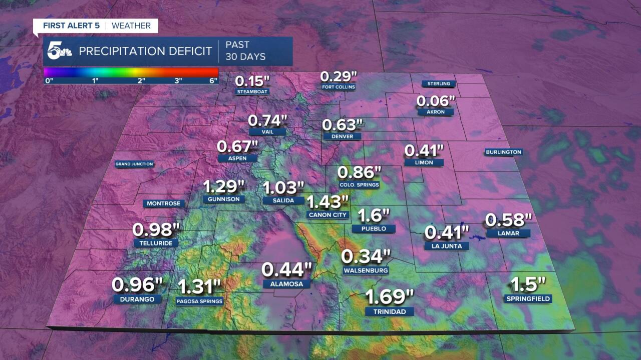
This first graphic paints sort of a grim picture of just how dry it's been lately in Colorado.
Check out Gunnison! They've only seen 2% of their average precipitation over the past 30 days.
Locally, Pueblo has only seen around a third of their normal precipitation, and Canon City has seen just 19% percent of the norm.

When looking at precipitation totals compared to normal, Canon City's deficit is nearly 1.5" off the average.
Pueblo is 1.6" behind it's norm for the past 30 days, with Colorado Springs 0.86" behind.
The southern mountains and southern I-25 corridor look to be in the worst shape this past month.
Trinidad's deficit for the past 30 days is nearly 1.7".

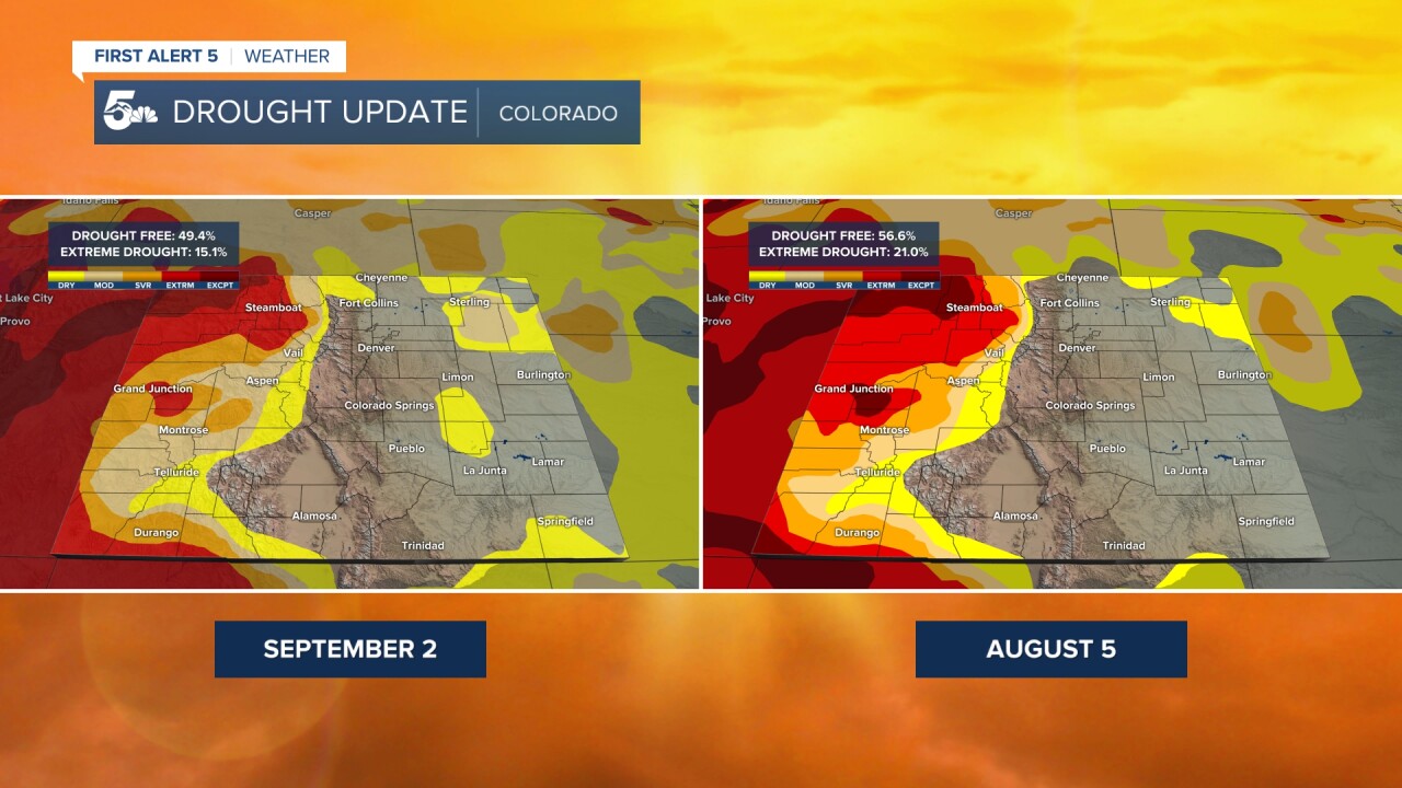
Taking a look at the latest drought monitor, nearly 50% of the state is currently drought free.
This is slightly worse than last month, when 57% of the state was drought free.
As you can see, drought has been creeping back into the Plains while still shrinking some over the Western Slope.

Looking ahead....we're expecting a hot and dry stretch of weather for the foreseeable future.
High pressure will keep us high and dry with hardly any rainfall expected through the weekend.
Without any significant storms over the next 5-7 days, Colorado's drought is likely to get worse before getting better.


