It's the first major winter storm of 2021 for the East Coast, and this evening it's burying the Northeast under feet of snow.
The storm is already packing a punch, with a crippling combination of heavy snow, gusty winds, freezing rain and coastal flooding.
Travel in these areas will be dangerous to impossible through mid-week as the storm barrels up the coast.

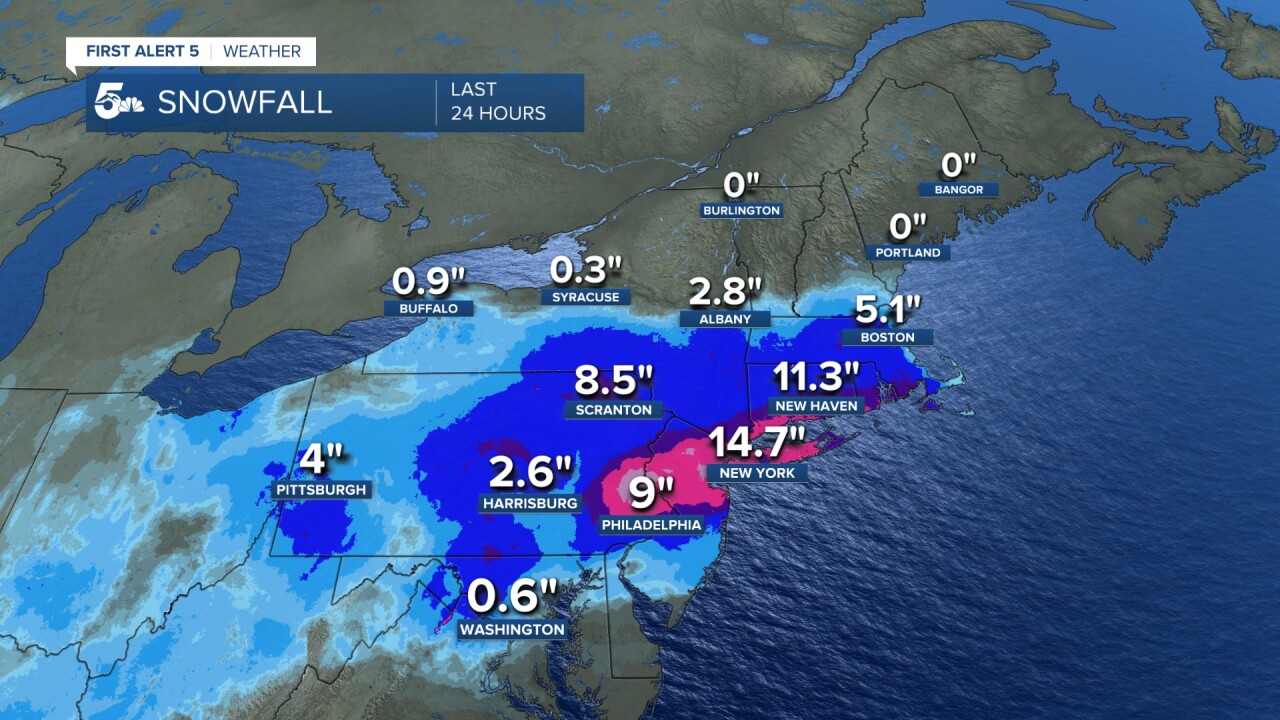
Snowfall totals from the past 24 hours have been impressive. A swath of heavier snowfall can be seen from eastern Pennsylvania through parts of New Jersey, New York and Connecticut.
Snow is expected to continue this evening from the Deep South to the Great Lakes, spreading into New England during the overnight hours.
This will be a slow-moving storm. Precipitation will be heavy and long lasting.
Along the coast where cold air is more shallow, a mix of rain, freezing rain and sleet will be possible along the I-95 corridor through Tuesday.
As the low moves slowly up the coast, the rain and snow will taper off over the Ohio Valley and southern Appalachians on Tuesday, but linger over parts of New England through Wednesday.

Additional snowfall totals of 6-12" will be possible for areas away from the immediate coastline through Wednesday evening.
By the time that it's all said and done, some interior areas from Pennsylvania to Maine could see more one to two feet of snow from the storm.
Nearly 75 million residents across at least a dozen states are being impacted, crippling many large metropolitan areas from New York City to Boston.
Another storm will hit the same area later this week, with the potential for more rain and snow. It will be a warmer storm, which could create flooding hazards in some areas.


