


We're over halfway through July - as usual summer is flying by. As we expected earlier in the season, it's been hotter and drier than average thus far. Thankfully we're getting a nice break this weekend on both fronts. Southern Colorado needs rain.

We're well below average along the southern Front Range Corridor. In the last 30 days we're between 35% and 55% of where we should be. But, heavy thunderstorms on the southeast plains mean you're above average. When I crunched the numbers, La Junta came out the rain-awards winner with 208% of your normal since June 21st...mostly due to two big storms on July 7th and July 16th.
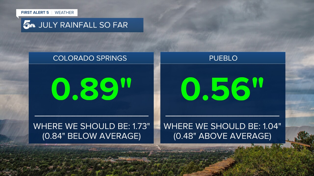
Meanwhile in Colorado Springs, we've got less than an inch in the bucket since July began. And in both Colorado Springs and Pueblo, we've got the glass half full...about 50% of the normal rainfall in both cities month-to-date. That's notable since July is historically the wettest month of the year in the Springs, and 2nd wettest in Pueblo (after August).

Current trends indicate most of the rest of the water we get this month falls by the middle of next week. After that, we dry back out a bit. It doesn't look like storm chances evaporate heading into August, but not widespread daily storm chances like we're experiencing currently. Instead, we'll be more focused again on heat.
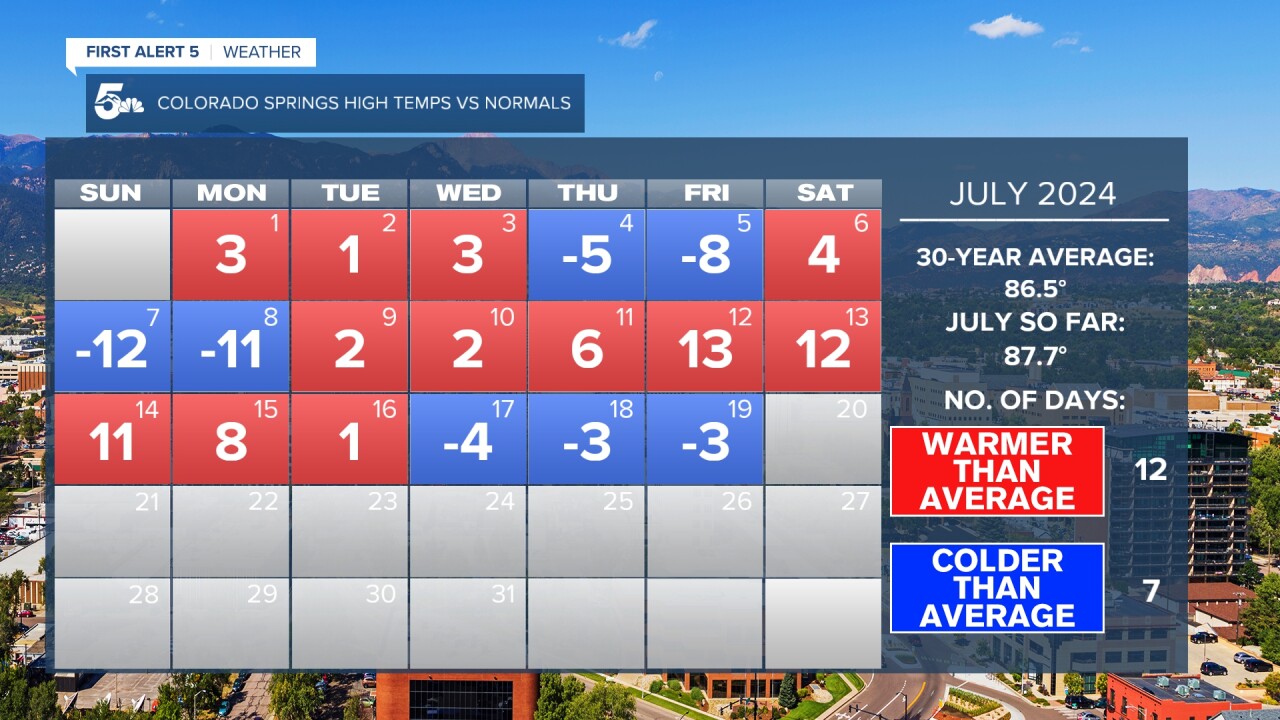
Speaking of heat - the second week of July...very hot right? Not just your imagination: the 100 degree high in the Springs on the 12th, and 106 in Pueblo are both daily records. In the Springs, it's close to all-timer (101 on June 26th 2012 and June 21st 2016 are the highest)...in Pueblo...you hit a scorching 109 on July 13th 2003...so although it was quite hot, you've seen hotter. Although the heat was record setting, the timing was predictable. The hottest two weeks of the year in both cities are the second and third week's of July.
As we look ahead - high pressure is the driver of most of our pattern for the next several weeks. This is the time of year where sub-tropical high pressure moves north. This does two things - it brings on the Monsoon, and it leads to heat. Whether we're more dealing with heat or storms depends on where the high wobbles around to. In this case, the trend is for the high to lead to more heat than storms.

The Climate Prediction Center's latest forecast reflects this. In contrast, the CPC also outlooks the state for below average rainfall.

Given that August is typically a peak monsoon season month - even with below average rainfall, you shouldn't expect it to be dry. We'll still get afternoon thunderstorm chances for the next several weeks. They're just likely to be more isolated and less frequent than in an average year. Notably the CPC forecast, while dry, is slightly less dry than they had outlooked for July.
____
Have a question or story idea you would like the First Alert 5 Weather team to consider? Email: weather@koaa.com
Watch KOAA News5 on your time, anytime with our free streaming app available for your Roku, FireTV, AppleTV and Android TV. Just search KOAA News5, download and start watching.
