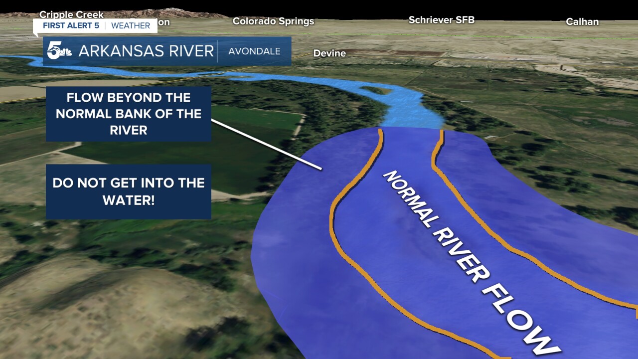
Flood waters have closed parts of popular trails and recreation areas along the Arkansas River. Flooding is occurring due to a combination of record warmth, and above average snow pack in the mountains.

The Arkansas Basin currently holds, on average, over an inch of liquid water equivalent in snow pack, about twice the normal amount for this time of year. This is down from 2 inches on June 1st, and 8 inches on May 14th. Meanwhile, over the last two weeks, temperatures have been well above average in the mountains with that trend ongoing this week. The high snowpack is partly due to a strong El Niño over the winter, while the current heat is partly attributable to a shift toward La Niña - both large scale weather patterns that can influence the placement of our jet stream, and therefore, our temperatures. The end result: lots of snow in the mountains, meeting strong June sunshine and temperatures 10-15 degrees above average.

All that water is funneling into the Arkansas River. Flooding occurs when the height of a river exceeds its bank. Rivers have a high capacity for changes in flow. In Cañon City, the river is currently flowing at nearly 5,000 cubic feet per second - enough to fill an Olympic sized swimming pool in 22 seconds. With this much water, the river speeds up - a lot - and also rises. The degree of flooding is characterized by severity. Minor flooding can submerge low-lying points on nearby roads, and cause minor erosion to the river bank. Moderate and major flooding ratchet up severity - with structures potentially threatened over a wider area.
But minor flooding is still dangerous. Even though the flood waters won't extend far from the bank, the dramatically faster and stronger flow of the river make land next to it prone to collapse, sweeping anything on the land above into the fast moving torrent. This is why officials in counties along the river have closed parts of trails, and are telling you to stay away from the river. Even if you're walking next to the river, with flow rates this high, you're still in danger. Avoid walking by the river, until waters recede. Similarly, if you encounter flood waters while driving, turn around, and find another route. The science is the same.

At Avondale, flood waters peaked at 8.97 feet around 10AM on June 10th. They've slowly declined since then, but future levels will be determined by releases from the Pueblo Reservoir upstream - which will depend on the flow coming in from Cañon City and Twin Lakes. Minor flooding is forecast to persist through the next few days in the 8-9 foot range.

At La Junta, flow is still rising, and forecast to peak Thursday morning somewhere near 11.5 feet, with minor flooding continuing into the weekend.

In Cañon City the river is rising as well. Flood stage is 10 feet, and the river is fluctuating around that level.
In general - flow will remain elevated until snowpack levels drop to zero, which should occur within the next week to two weeks outside of the very highest terrain on shaded slopes. Until then, with more record heat ahead, you'll want to put off your plans to recreate in the Arkansas River.
____
Have a question or story idea you would like the First Alert 5 Weather team to consider? Email: weather@koaa.com
Watch KOAA News5 on your time, anytime with our free streaming app available for your Roku, FireTV, AppleTV and Android TV. Just search KOAA News5, download and start watching.


