Have you ever wondered why Pueblo seems to miss out on bigger snow storms?
Called the Pueblo Precipitation Doughnut Hole, or the Pueblo Doughnut Hole for short, it's a name that resonates with residents of Southern Colorado.
We see this when a storm that appears to be on track to hit Pueblo skips right past the city, leaving us high and dry.
But how and why does this occur?
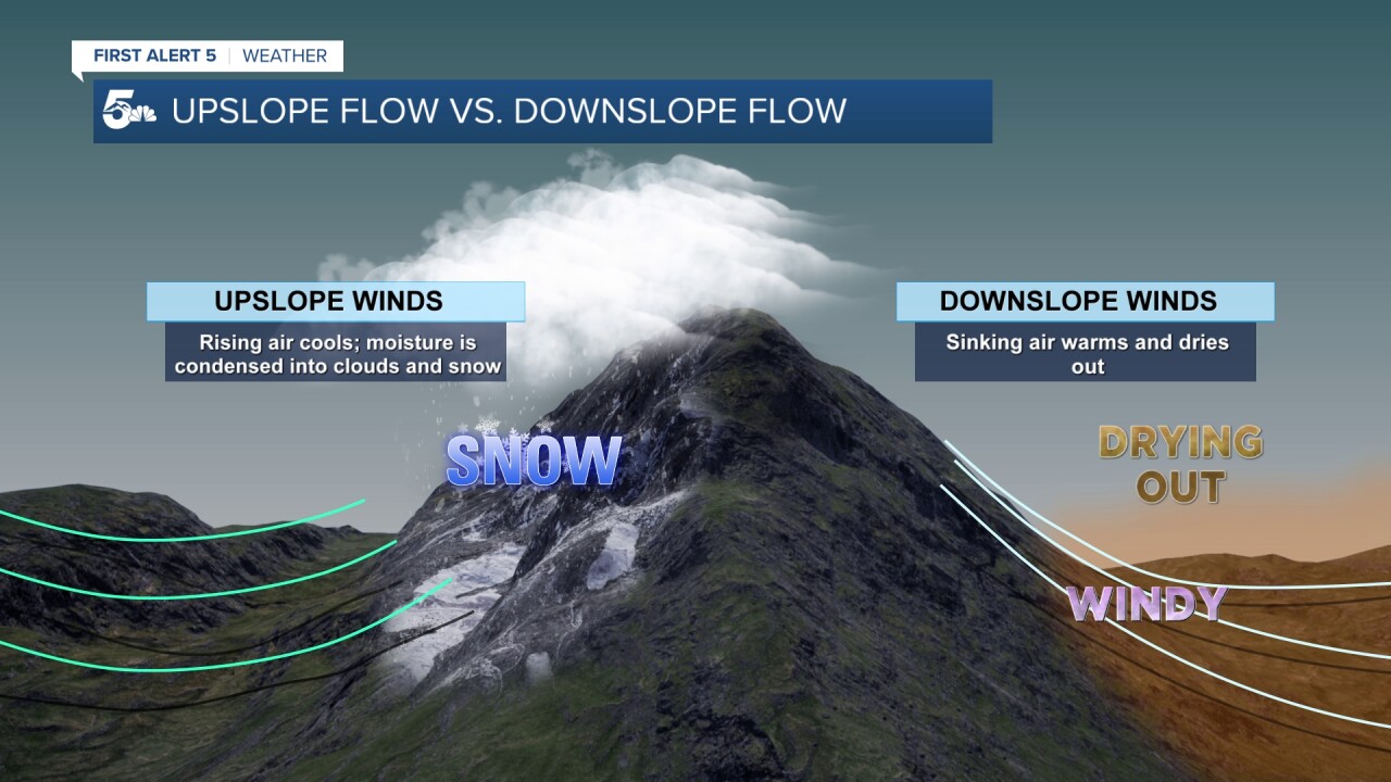
On this graphic below, let's say that we're looking at the Wet Mountains, which are located just west of Pueblo.
Air flowing from west to east will be forced to rise up and over the mountains, squeezing out most of the precipitation on the western slopes and over the high mountain peaks.
This is referred to as the windward side of the mountains.
Sinking air on the east side of the mountains, or leeward side, will have the opposite effect...leaving Pueblo dry.

In the case of the Pueblo Doughnut Hole, we're also prone to experience dry, downslope conditions from a north wind that drops in from the Pikes Peak Region, and a south wind blowing in from the Raton Mesa.

Directionally, downslope winds have got us covered in Pueblo most of the time. So, what does it take for us to generate a wetter, upslope flow?
Think the Albuquerque low!
Low pressure tracking to our south over New Mexico is just what we need to send an easterly, upslope wind towards Pueblo.
It's exactly what's required to bring maximum snow potential to the Steel City...and that's something that we haven't seen too much of this season so far.

Looking at the Drought Monitor, we can see the current effects of drought within the Pueblo Doughnut Hole, with areas of severe drought over a large portion of the county.
Along the Palmer Divide and across the mountains, drought is much less severe.

Lastly, let's take a look at the latest season-to-date snowfall numbers.
Denver has already seen 35" of snow, with Pueblo only reporting 6.6".
Colorado Springs has seen more than 15" of snow, and is currently above average for the season, while Pueblo needs to catch up.

That said...don't sleep on Pueblo as February and March are known to produce big storms, with heavy, wet snow and lots of water content.


