Drought dry conditions are contributing to today's fire danger, and as Lead Forecaster Mike Daniels has mentioned, there's not much help from Mother Nature through the weekend.
Dry vegetation and the lack of recent rainfall in Colorado Springs is not helping the situation either.

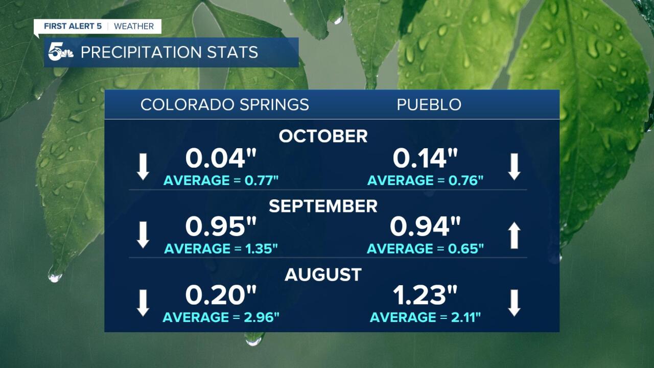
Twenty days into October and we're barely scrapping by with only 0.04" of precipitation at the Colorado Springs Airport.
The first and 14th of the month have been the only days with measurable rainfall.

Pueblo has done only slightly better, with 0.14" of rainfall.
September brought both airports close to an inch of rain, which was below average in the Springs and above average for Pueblo.
August was exceptionally dry in Colorado Springs, but also below average in Pueblo.
Since our First Alert 5 forecast is basically dry for the next 7 days, let's look a little further out.

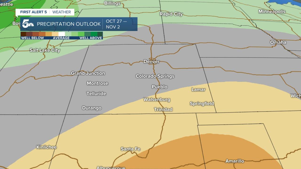
This is the 8-14 Day Outlook from the Climate Prediction Center and this map favors a better chance of below average precipitation for southeastern Colorado.
From Pueblo County to the Pikes Peak Region, we see the potential for near normal precip from late October through early November.
Other than a weak change of rain or snow next Tuesday, we're also watching the potential for stronger winds and high fire danger to return to parts of Southern Colorado early next week.


