Tonight's Forecast:
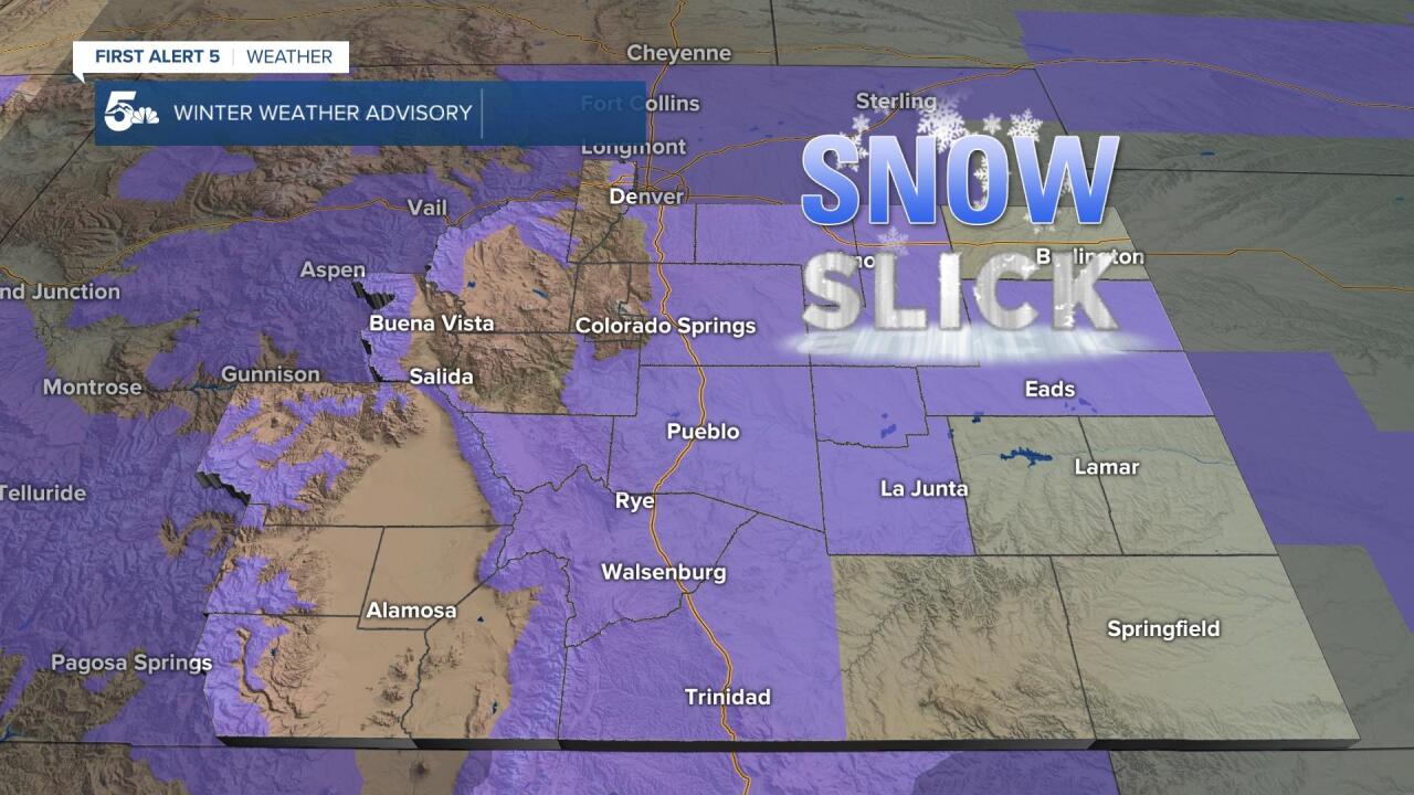
Windy and cold tonight as we're now situated behind a polar cold front that swept through the region earlier today. Periods of snow will fall across Southern Colorado until just after midnight, with a break in the activity expected by very early Thursday morning. Winter Weather Advisories will remain in place across El Paso County until Thursday morning, but last through late Thursday night or early Friday morning across most of the rest of the News 5 viewing area.

Colorado Springs forecast: Low: 5; High: 18; Thursday will be the coldest day of the week for Southern Colorado. A break in the snow during the overnight hours will give way to a second round of snow by the afternoon. This one looks to favor areas south of the Pikes Peak Region with the heaviest snowfall.
Pueblo forecast: Low: 6; High: 21; Round #1 will wind down during the overnight hours, with a break for most of the day Thursday. By Thursday evening, a second piece of energy will drop into the Arkansas River Valley, with periods of heavy snow possible into early Friday morning.
Canon City forecast: Low: 8; High: 20; Tonight's snowfall will most likely come to an end just after midnight as dry air punches into the region. Another round of snow is expected to impact the central Arkansas River Valley beginning late Thursday afternoon, with snow possible into Friday morning.
Woodland Park forecast: Low: -1; High: 16; Very cold this evening, with periods of snow across Teller County through just past midnight. We'll see a break from the snow showers early Thursday before a second round skirts the region tomorrow afternoon. Most of the heavier stuff should stay to our south.
Tri-Lakes forecast: Low: -0s/0s; High: 10s; A Winter Weather Advisory will remain in place across the Palmer Divide until 11 am as most of our snow is expected to taper off by early Thursday morning. Another round of snow will mainly stay to our south tomorrow, but could be close enough to bring a few snow showers to the region by the afternoon.
Plains forecast: Low: 0s; High: 10s/20s; Snow showers tonight will taper off by early Thursday morning, followed by a brief lull in the action. A second round of snow will push into the Plains by late tomorrow afternoon and evening, with the snow coming to an end by early Friday morning.
Walsenburg and Trinidad forecast: Low: 0s; High: 10s/20s; The southern I-25 corridor and southeastern mountains will bear the brunt of this storm. Between 1-3" of snow will be possible tonight, with another round of heavy snow on Thursday afternoon and evening that could drop another 4-6" of snow to our forecast.
Mountains forecast: Low: -0s/0s; High: 0s/10s; A cold, windy and snowy night for the mountains. A small break in the action will be possible tomorrow morning before a second round of heavy snow impacts the mountains Thursday afternoon and evening. Winter Weather Advisories are set to continue in the high country until 5 am Friday.
Extended outlook forecast:
As the snow clears out late Thursday night, temperatures Friday morning will be frigid across the region.

Along with the cold will come potentially dangerous wind chill values as low as -5 to -15 degrees across parts of Southern Colorado. Leftover cold will hang on through Friday, with highs not much warmer than the freezing mark. Warm downslope conditions will develop over the weekend, and highs by Sunday will be around 25-35 degrees warmer than Thursday. A weak storm system will cool us down briefly on Monday, but snow is not likely at this time.
____
Curious about the First Alert 5 Weather Storm Impact Scale? Check out our cheatsheet explainer.
Watch KOAA News5 on your time, anytime with our free streaming app available for your Roku, FireTV, AppleTV and Android TV. Just search KOAA News5, download and start watching.


