

Today’s Forecast:
Much like the past few days, we'll see another round of showers and thunderstorms across Southern Colorado on Wednesday. Storms will blossom over the mountains as early as the lunch hour, and then spread east towards the I-25 corridor. Storms this afternoon and evening will be capable of gusty winds, lightning, and brief, heavy rainfall.
Afternoon highs will be slightly cooler region-wide, with 80s and lower 90s on the Plains, and 70s in the mountain valleys.
Colorado Springs forecast: High: 83; Low: 52. As skies turn unsettled this afternoon, we'll see some spotty showers and thunderstorms move across the Pikes Peak Region, with showers expected to dissipate after sunset this evening.
Pueblo forecast: High: 90; Low: 53. Mostly sunny skies early will give way to a mostly cloudy afternoon, along with the potential for a few showers or thunderstorms into early this evening.
Canon City forecast: High: 87; Low: 57. Summer isn't done with Southern Colorado just yet, with highs around 5 degrees above average today in Canon City, and the chance for spotty thunderstorms this afternoon and evening.
Woodland Park forecast: High: 74; Low: 44. Warm, with scattered thunderstorms this afternoon and early this evening that will be capable of frequent lightning and gusty winds.
Tri-Lakes forecast: High: 70s/80s; Low: 40s/50s. Highs will be slightly cooler than yesterday, but still above average. To add to the warmth, we can expect the potential for some showers and thunderstorms this afternoon and evening.
Plains forecast: High: 80s/90s; Low: 50s/60s. Sunshine early will give way to another hot afternoon, with a slightly better chance of a shower or thunderstorm today for the eastern Plains.
Walsenburg and Trinidad forecast: High: 70s/80s; Low: 40s/50s. It's going to be a warm one on Wednesday for the southern I-25 corridor, with increasing clouds this afternoon and the potential for a few thunderstorms.
Mountains forecast: High: 40s; Low: 20s. No big changes to our forecast today in the mountains, with dry skies this morning giving way to scattered showers and thunderstorms this afternoon and early this evening.
Extended outlook forecast:
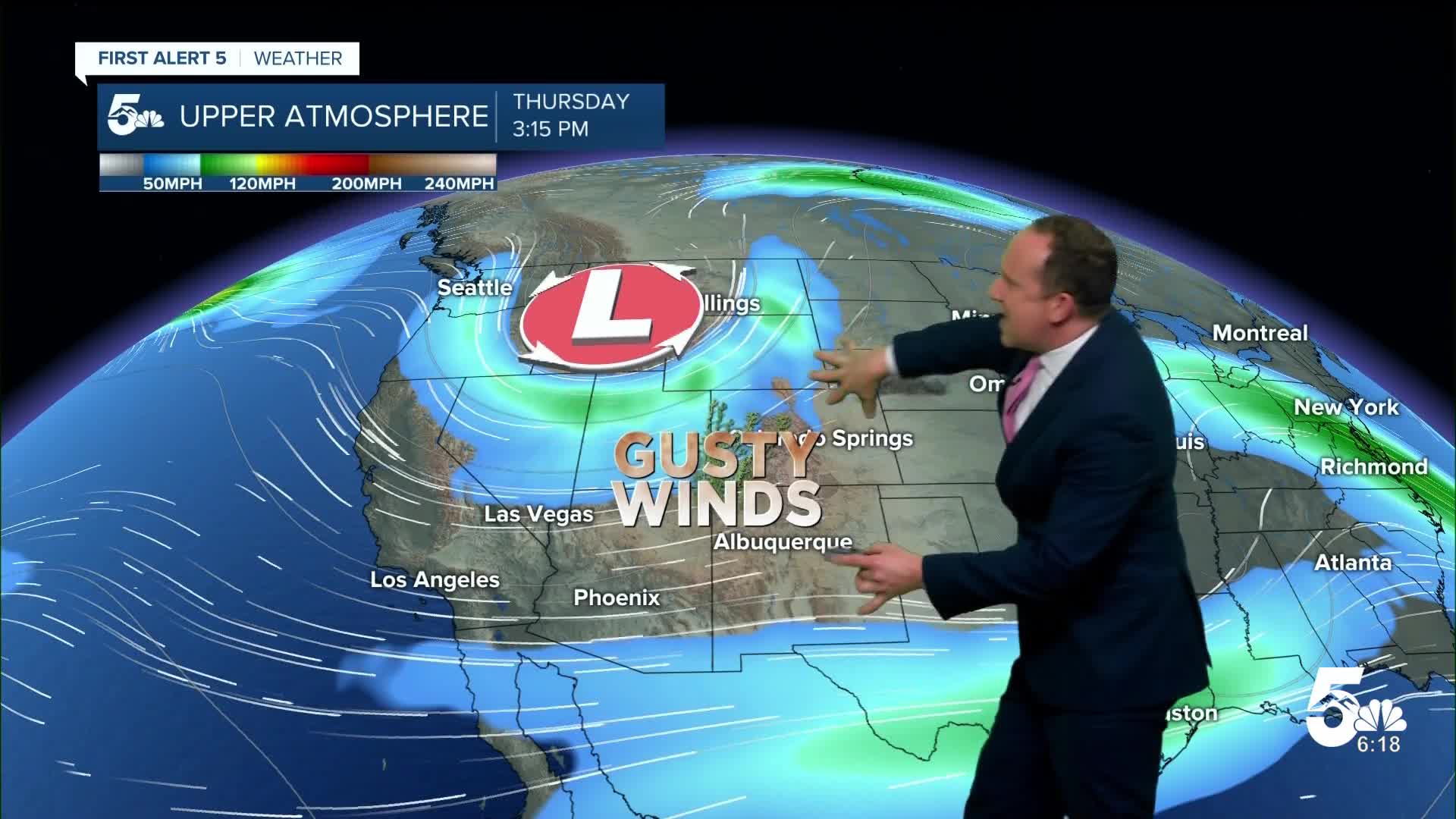
With gusts to 30 mph on Thursday and relative humidity in the teens, fire danger threats will be critical across parts of Southern Colorado. A Fire Weather Watch has been issued from noon to 8 pm on Thursday. This watch is likely to get upgraded to a Red Flag Warning.
Highs on Thursday will be hotter because of the downslope wind, topping out in the 80s and 90s on the Plains. It will remain breezy on Friday before we transition to a quiet weekend, with lower 80s for highs and partly cloudy skies in Colorado Springs. Showers will be possible by Sunday afternoon in the mountains.
____
Curious about the First Alert 5 Weather Storm Impact Scale? Check out our cheatsheet explainer.
Watch KOAA News5 on your time, anytime with our free streaming app available for your Roku, FireTV, AppleTV and Android TV. Just search KOAA News5, download and start watching.
