
Tonight's Forecast:
A high-pressure system continued to strengthen today, which brought warm and dry conditions. We will continue to see this high-pressure system move to the East and stick with warm and dry conditions. Some places tomorrow could tie the record high. We could see some small and isolated storms near the southern Sangres and San Juans tomorrow.
Colorado Springs forecast: Low: 57; High: 87;
Temperatures tonight will be a little more mild with numbers only getting into the upper 50s. A high-pressure system is currently bringing us dry and warm conditions. This will continue into tomorrow and we could likely tie the record high that was set back in 1933. The high tomorrow will reach 87 degrees.
Pueblo forecast: Low: 55; High: 93;
Tonight's lows will get down into the mid-50s with calm and clear conditions. Highs tomorrow will be back in the lower 90s. This heat will likely stick with us through the week, but a couple of cold fronts will give us a little break.
Canon City forecast: Low: 60; High: 90;
Calm and clear conditions will be with us tonight and temperatures will be in the lower 60s. Highs tomorrow will be right back up into the lower 90s. We could see some breezy conditions tomorrow, but nothing too dramatic.
Woodland Park forecast: Low: 46; High: 78;
Lows tonight will be in the mid-40s, along with calm and clear conditions. Highs will be back into the upper 70s. A cold front will push through which will drop temperatures a few degrees on Tuesday. Highs in the 70s will be the story for most of the week.
Tri-Lakes forecast: Low: 56; High: 83;
We are looking at another calm and clear night ahead with temperatures in the mid-50s. Going into tomorrow, temperatures will be in the lower 80s. The heat will likely stick around for the majority of the week.
Plains forecast: Low: Upper 40s/ Lower 50s; High: Upper 80s/ Lower 90s;
We are seeing more severe drought conditions in the Plains, specifically just east of Lamar. We will continue to see these hot and dry conditions tomorrow due to a high-pressure system. Temperatures tonight will dip into the upper 40s/lower 50s. Highs tomorrow will be back in the upper 80s/ lower 90s.
Walsenburg and Trinidad forecast: Low: 56/54; High: 86/87;
Another calm and clear night is ahead of us with temperatures reaching the mid-to-lower 50s. This isn't as cold as what we have been seeing. Highs tomorrow will be back in the mid-to-upper 80s. We will likely see warm and dry conditions throughout the week.
Mountains forecast: Low: 40s; High: Upper 70s;
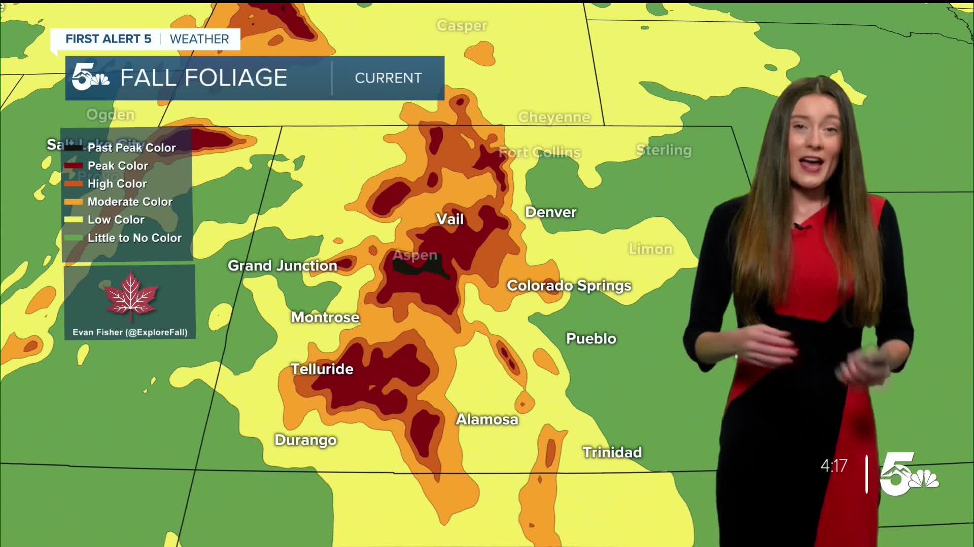
The mountains are starting to reach peak foliage in certain places such as Aspen, Leadville, and Vail. We will continue with this trend throughout the week. These warmer conditions could help to push these colors past their peak and we could see more browns mixed in with the yellows. As for the temperatures, the highs tomorrow will be back in the upper 70s.
Extended outlook forecast:
We will continue to see above-average temperatures this week, but on Tuesday we could get a little taste of some cooler weather. This won't last long though because that high pressure will rebuild and bring back the above-average temperatures.
____
Curious about the First Alert 5 Weather Storm Impact Scale? Check out our cheatsheet explainer.
Watch KOAA News5 on your time, anytime with our free streaming app available for your Roku, FireTV, AppleTV and Android TV. Just search KOAA News5, download and start watching.
