


Disclaimer: This is sponsored content. All opinions and views are of Monarch Mountainand does not reflect the same of KOAA.
A winter storm has been rolling through the western slope of Colorado since late Wednesday, and with multiple disturbances moving in from both the equatorial pacific, and the pacific northwest - the slopes are grabbing a lot of beneficial snowfall.
This weekend will continue a trend of weekend storms in the high country. While conditions have been good this week for snowmaking, natural snow will be the theme this weekend. That also means roads will be slippery and snow covered west of the continental divide all weekend.

Telluride will open for the season Saturday, with most of our other area resorts already open. Significantly more terrain has opened at many resorts thanks to a combination of the aforementioned winter storms and the solid snowmaking conditions.

More terrain is set to open soon at many resorts due to snowmaking. With the major totals through next Monday, expect to see even more of a jump in available terrain by the end of next week.
Forecast wise, if you plan to ski this weekend you need to know a few things:
- It will be snowing all weekend. Heavy at times with banding snow resulting in 1-2"/hr rates. We're looking at significant totals.
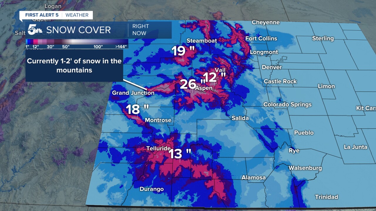
 KOAA
KOAASnow totals through Monday at Colorado's Ski Resorts - It will be windy all weekend, both Saturday and Sunday. Models have gone back and forth over which day is windier. But, in summary, the farther west you go, the earlier the peak winds will arrive for you. Right now, Saturday night is the worst at Vail with 50+ mph gusts, Sunday looks very windy at Breckenridge with wind gusts to 55 mph. On Sunday, wind gusts at Loveland may reach 70 mph. Plan on blowing snow both days, with windier conditions for most resorts Saturday night into Sunday.


- It will be very cold, with highs in the low 20s at bases both days (subtract 10 degrees for the summits as a broad brush estimate). Add in the windchills and we're talking negative-feeling temperatures.
If you can afford to wait until Monday that's your best option. You'll get the benefit of a ton of fresh powder, lighter winds, and clearing skies. If you do want to ski this weekend, areas that are farthest west of the continental divide are your best bet. Telluride for example, will have wind gusts of only 15-20 mph both Saturday and Sunday. At Wolf Creek, Saturday winds gust to 25 mph, Sunday to 35. That'll still create blowing snow - but relatively the lighter spot.
__
Watch KOAA News5 on your time, anytime with our free streaming app available for your Roku, FireTV, AppleTV and Android TV. Just search KOAA News5, download and start watching.
