


Today’s Forecast:
After a cold front swung through overnight, today will be noticeably cooler and seasonable. That cold front leads to storm chances today during the afternoon.
Today will feel a bit sticky and humid with our airflow coming from the southeast. This will lead to dew points, which measure how wet or dry the air is, into the 50s and 60s later today. By Colorado standards, that's air you can wear.
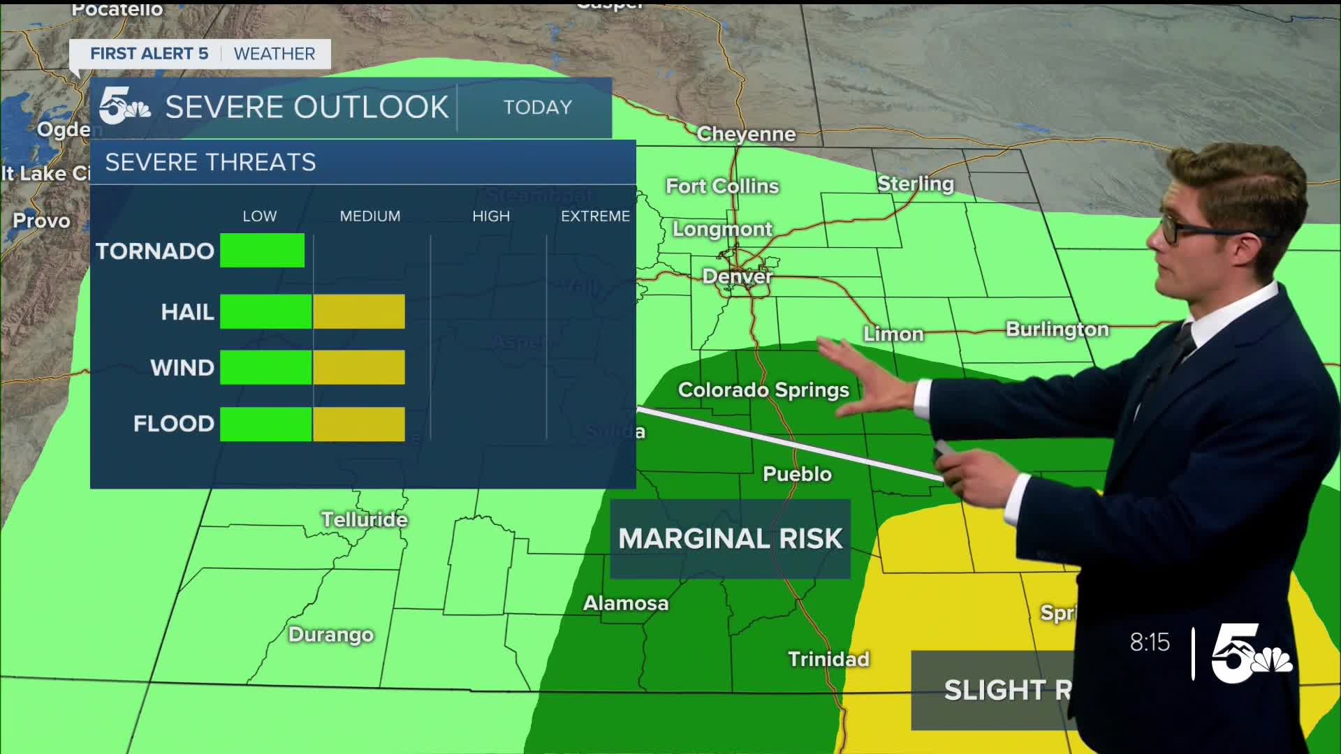
Thunderstorm timing today will be fairly late - in the 3PM-7PM time frame along I-25. That means a good chunk of your day is going to be fine weather-wise. When storms do arrive...a few will be capable of heavy rain and flash flooding, strong wind gusts to 60 mph, and quarter sized hail (1" diameter). Garden variety storms will still contain dangerous lightning. Remember: if you can hear thunder, you can be struck by lightning. Have a place to go indoors if you hear thunder or see a storm approaching.
Colorado Springs forecast: High: 82; Low: 59.
A blend of clouds and sun and breezy this morning with northerly winds following a cold front. Winds shift southeast this afternoon bringing in humid air. Sunshine in the early afternoon will be followed by storms in the late afternoon hours. Some storms could contain heavy rain, small hail, and gusty winds.
Pueblo forecast: High: 87; Low: 61.
Refreshingly warm today in the steel city. Mostly sunny and this morning with northerly winds following a cold front with gusts from the north at 35 mph. Winds shift southeast this afternoon bringing in humid air. Sunshine in the early afternoon will be followed by storms in the late afternoon hours. Some storms could contain heavy rain, small hail, and gusty winds.
Canon City forecast: High: 85; Low: 63.
Mostly sunny this morning and breezy. Scattered thunderstorms this afternoon. Storms may dump heavy rain - have a place to hop inside when you see the clouds darken or hear thunder. Storm timing is looking to be after 2:00PM today. Southeast winds at 10-15 mph.
Woodland Park forecast: High: 74; Low: 50.
Mostly sunny with scattered afternoon thunderstorms. Parts of Teller County will get more than one round of storms today. Generally garden variety stuff but good lightning and heavy rain. Southwest winds at 10-15 mph.
Tri-Lakes forecast: High: 70s; Low: 50s.
Mostly sunny this morning and breezy with wind gusts to 40 mph from the north, winds shift southeast this afternoon and reduce to 10-15 mph. Scattered afternoon thunderstorms. A stronger storm with small hail and gusty winds is possible - but odds are better to the south.
Plains forecast: High: 80s; Low: 60s.
Partly cloudy this morning, very humid this afternoon with east winds at 10-20 mph. The humidity leads to afternoon and evening thunderstorms. Severe thunderstorms are likely, particularly over the most southeastern counties of the state. Have at least two ways to receive weather warnings this afternoon.
Walsenburg and Trinidad forecast: High: 81/82; Low: 59/60.
Sunny this morning, partly sunny this afternoon with scattered afternoon thunderstorms. Southeast winds at 10-15 mph.
Mountains forecast: High: 70s; Low: 50s.
Sunny to partly cloudy depending on the mountain range through the morning. Widespread afternoon heavy thunderstorms, with chances starting at noon. Be off of exposed summits and terrain before noon today if hiking, climbing, mountain biking (etc). Storms will be capable of heavy rainfall and frequent lightning, particularly in the southern mountains. Remember: if a flash flood occurs, climb to higher ground. Southeast winds at 10-15 mph.
Extended outlook forecast:
We've got more action in the weather cauldron on Sunday, as we continue to mix together upslope flow, tropical upper-level moisture, upper-level energy, and heat that all up with our hot and potent June sunshine. Sunday will start off with clouds on much of the corridor, left over from the late storms you'll see today. These clouds will eventually dissipate during the late morning into the early afternoon. Timing here will be key - if the clouds hang tough for longer, it'll tamp down our storm odds on Sunday. Scattered afternoon thunderstorms will be possible, and timing is likely to be earlier, in the 1-3PM range, as instability increases earlier in the day. Highs rebound as a warm front crosses the area but the extra clouds will temper that warm up.
High pressure brings back the heat for the first half of next week - although not as hot as last week - with isolated storm chances each afternoon. it'll be less likely for you to see a storm than either Saturday or Sunday. We'll dry out by July 4th outside of the mountains, with temperatures still slightly above average.
____
Curious about the First Alert 5 Weather Storm Impact Scale? Check out our cheatsheet explainer.
Watch KOAA News5 on your time, anytime with our free streaming app available for your Roku, FireTV, AppleTV and Android TV. Just search KOAA News5, download and start watching.
