
Today’s Forecast:
Widespread fire danger is expected this afternoon... but it won't really feel like it with temperatures in the 40s and 50s!
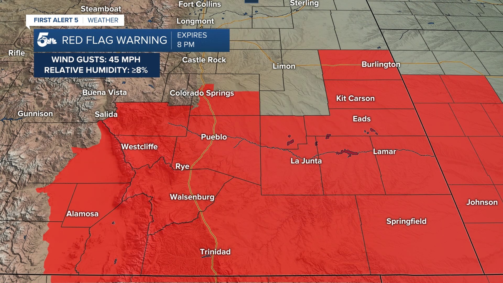
Fire danger comes from 20 to 45 mph wind gusts and relative humidity values below 15 percent in the afternoon and early evening. Daytime temperatures will be around 10 degrees below average with virga mixed with light rain/snow showers along the Front Range.
Colorado Springs forecast: High: 50; Low: 24. Mostly sunny to mostly cloudy through the afternoon with chilly temperatures and 20 to 30 mph wind gusts. Virga or isolated rain showers are possible this afternoon but most of the accumulating rain or snow stays up on top of the mountains.
Pueblo forecast: High: 58; Low: 24. Mostly sunny to mostly cloudy with cool temperatures and wind gusts in the 30 mph range. We'll stay dry today with just a little blowing dust in the afternoon.
Canon City forecast: High: 54; Low: 27. Mostly sunny to mostly cloudy with mild temperatures and wind gusts in the 30 mph range. A little virga mixed with a spotty shower is possible in eastern Fremont County, mainly in towns right next to the mountains.
Woodland Park forecast: High: 37; Low: 16. Mostly cloudy, windy, and cold today with flurries or light snow showers in the afternoon and evening. Any snow accumulation would be light and mainly confined to the grass.
Tri-Lakes forecast: High: 40s; Low: 20s. Mostly sunny to mostly cloudy, windy, and cold virga or flurries in the afternoon and evening. Wind gusts will be in the 20 to 30 mph range.
Plains forecast: High: 50s; Low: 20s. Mostly sunny to mostly cloudy with windy and mild and dry afternoon conditions. Wind gusts will be in the 20 to 39 mph range.
Walsenburg and Trinidad forecast: High: 50s; Low: 20s. Anther very windy day with gusts in the 30 to 40 mph range with more daytime fire danger.
Mountains forecast: High: 40s; Low: 10s. Scattered snow showers across the Front Range with the most accumulation expected back in the Sawatch range.
Extended outlook forecast:
Friday will be slightly warmer than Thursday, but with less fire danger. Red Flag Warnings will go into effect from Pueblo to Trinidad along I-25 with most of the San Luis Valley included.
Snow showers are expected Friday night through Saturday morning with light pavement accumulations over 6,800 feet
____
Curious about the First Alert 5 Weather Storm Impact Scale? Check out our cheatsheet explainer.
Watch KOAA News5 on your time, anytime with our free streaming app available for your Roku, FireTV, AppleTV and Android TV. Just search KOAA News5, download and start watching.
