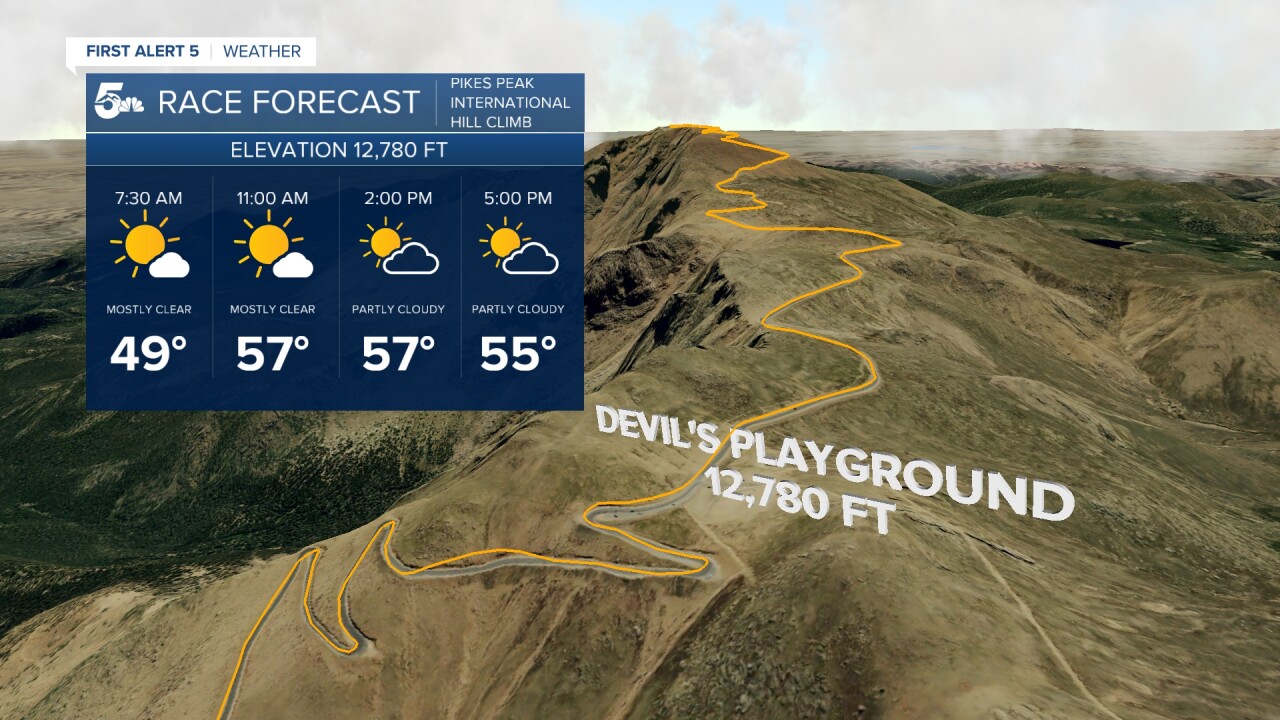
Today’s Forecast:
A weak cold front pushed south through Colorado Springs early this morning associated with a surface low moving out of the northeastern part of the state. This front has temporarily brought in more moisture to the region, allowing for overnight cloud cover and fairly mild low temperatures. However, as the sun rises, much of this moisture will move east with a westerly dry airflow in place. We'll have a period of mainly sunny conditions in mid-morning, with partly cloudy skies for a good chunk of the day.
The big story today is a building ridge of high pressure building into the Centennial State. With water levels in our atmosphere dropping, we'll drop our storm chances. We'll have a chance for a few isolated afternoon mountain showers. Your best chance to see a few drops from the sky is in the mid to late afternoon when a bit of elevated storm energy around the height of Pikes Peak's summit could give us a brief shower. Feel free to enjoy a long hike today - thunderstorms are unlikely, with highs similar to yesterday in the upper 80s in the Pikes Peak Region. Winds will be out of the east southeast at 5-10 mph in the morning, and 5-15 mph in the afternoon.
Colorado Springs forecast: High: 89; Low: 58.
Partly cloudy in the morning with mostly sunny skies this afternoon and a 2-in-10 chance for a late day light shower. Southeast winds at 10-15 mph.
Pueblo forecast: High: 94; Low: 64.
Mostly sunny and warm! East winds at 5-15 mph. If you plan to walk your dog today, remember to check pavement temperatures. If it's too hot to comfortably hold your hand on the ground for 10 seconds, it's too hot for their paws.
Canon City forecast: High: 90; Low: 62.
Partly cloudy this morning, with "more sun than clouds" this afternoon. A 3-in-10 chance for an afternoon quick shower or storm. Don't cancel/change your plans...with high pressure in place, your main concern today is warmth, so bring the water bottle and enjoy a great weekend! Southeast winds at 5-10 mph.
Woodland Park forecast: High: 76; Low: 51.
Mostly sunny with periodic clouds and comfortable warmth. A 3-in-10 chance for an afternoon thunderstorm. If you get one, it'll be rather unimpressive: instability is low today as is moisture, so any storm would be weak. Main story: enjoy the nice weather! West winds at 10-15 mph.
Tri-Lakes forecast: High: 70s; Low: 50s.
Morning clouds, afternoon sun, with a late day quick shower possible. Northeast winds at 5-10 mph. Your bike ride plans on the New Santa Fe trail will be just fine.
Plains forecast: High: 90s; Low: 60s.
Partly sunny and hot with northeast winds at 5-15 mph.
Walsenburg and Trinidad forecast: High: 85/86; Low: 60/62.
Partly sunny, and warm with west winds in the morning, east winds in the afternoon at 10-15 mph - which may lead to a brief passing shower tonight. It's a nice summer day.
Mountains forecast: High: 70s; Low: 50s.
Partly sunny with isolated mid to late afternoon showers and a couple weak thunderstorms - primarily over the mountain tops. North winds at 5-10 mph.
Extended outlook forecast:
We're going to be hot, hot, hot, for much of next week. It's summer and it will feel like summer. A large dome of high pressure will build into the state on Sunday and will remain in place for much of the week. 90s in the Pikes Peak Region, triple digits in the Arkansas River Valley. Each day will have slightly different specifics - cloud cover and mountain shower chances, but the main feeling is by far the heat. For reference, the record high Monday in Colorado Springs is 100 degrees set in 2012, on Tuesday it's 98 also in 2018. My forecast keeps us a few degrees below those numbers -in the 95 degree range - but they'll still be days you'll want your walk, jog, or run to be first thing in the morning or well into the evening.
We keep the stove turned up on Wednesday, but we'll add the pot of water to it as tropical moisture moves into the state. This will lead to decent afternoon thunderstorm chances, making the second half of the final week of June both hot, and unsettled.
____
Curious about the First Alert 5 Weather Storm Impact Scale? Check out our cheatsheet explainer.
Watch KOAA News5 on your time, anytime with our free streaming app available for your Roku, FireTV, AppleTV and Android TV. Just search KOAA News5, download and start watching.


