


Today’s Forecast:
Another breezy day is ahead for southern Colorado, but no blizzards to be found today.
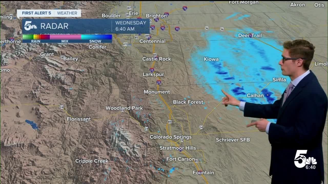
- Snow showers in the E plains this morning along US 24 between the Springs and Limon.
- Expect 30-40 mph wind gusts to develop north to south this morning. Gusty winds will be found north of US 50 and east of I-25. Thus, lower in Woodland Park and Canon City. Breezes decrease after sunset around 5:00PM.
- Highs in the low to mid 40s for most.
A truly massive area of low pressure - around 2,000 miles wide is centered over Missouri. That's the system that brought yesterday's blizzard - today it brings us wind and some clouds. But if you have loved ones returning to Colorado today, or you are yourself - make sure to check your check with their airline before leaving for the airport. This low is bringing rain, wind, snow, and fog from Colorado to Massachusetts!
If driving - roads are snow covered between Monument and Centennial with some slick spots on I-25 and particularly on side streets. Similarly US-24 from the Springs to Limon. They'll thaw out this afternoon with temperatures warming above freezing.
Clouds during the morning with more sun in the afternoon as dry air arrives.
Colorado Springs forecast: High: 43; Low: 19.
Normal high today in the Springs is 44, and we'll be close to that mark today if not right over it. Partly sunny with north winds at 15-30 mph, with 45 mph gusts east of I-25. West of I-25, lower winds.
Pueblo forecast: High: 48; Low: 18.
Mostly sunny with some patchy afternoon clouds. Northwest winds 10-15 mph, with gusts to 40 mph east of I-25.
Canon City forecast: High: 48; Low: 24.
Partly cloudy with northeast winds at 10-15 mph, becoming east during the afternoon. A relatively pleasant day by December standards.
Woodland Park forecast: High: 35; Low: 13.
Partly cloudy during the morning clearing during the afternoon. Occasional blowing snow with north winds 10-15 mph gusting to 30 mph. Winds decrease after 12PM.
Tri-Lakes forecast: High: 30s; Low: Teens.
Breezy with north winds 10-30 mph, gusting to 45 mph east of I-25. Mostly cloudy becoming mostly sunny in the afternoon. Patchy blowing snow.
Plains forecast: High: 40s; Low: Teens.
Breezy with north winds 10-25 mph gusting to 45 mph. Mostly cloudy becoming partly cloudy in the late afternoon.
Walsenburg and Trinidad forecast: High: 41/43; Low: 18/17.
Mostly sunny with north winds 10-15 mph.
Mountains forecast: High: 40s; Low: 10s.
Partly cloudy with patchy blowing snow, mainly before noon. Northwest breezes at 10-20 mph.
Extended outlook forecast:
Quiet weather with a warming trend through Saturday - Friday is my pick of the week across southern Colorado with highs in the 50s and lots of sunshine. A cold front will push temperatures back to seasonable for New Year's Eve, with seasonable clouds and sun conditions thereafter. We'll be unsettled mid-next week with upper-level weather makers rolling through - this may lead to some mountain snow.
____
Curious about the First Alert 5 Weather Storm Impact Scale? Check out our cheatsheet explainer.
Watch KOAA News5 on your time, anytime with our free streaming app available for your Roku, FireTV, AppleTV and Android TV. Just search KOAA News5, download and start watching.
