


7 am Update: Snow Totals
Snow reports are starting to trickle in with around a half inch to an inch along the Highway 50 corridor and 1 to 3 inches through the Pikes Peak Region.
How cold is it today?
Arctic air with dangerous wind chills has invaded Colorado with negative temperature readings along the entire interstate from Wyoming to New Mexico.
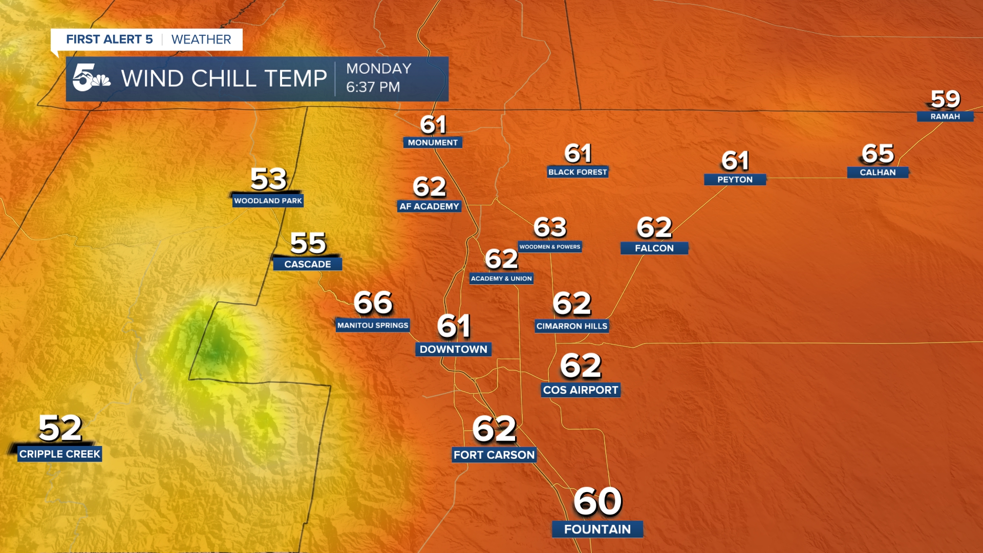
Wind chills are broadly in the -10 to -40 degree range as of 6 am and could stay that cold through noon.
Current Pikes Peak Region Wind Chills
Current Southern Colorado Wind Chills
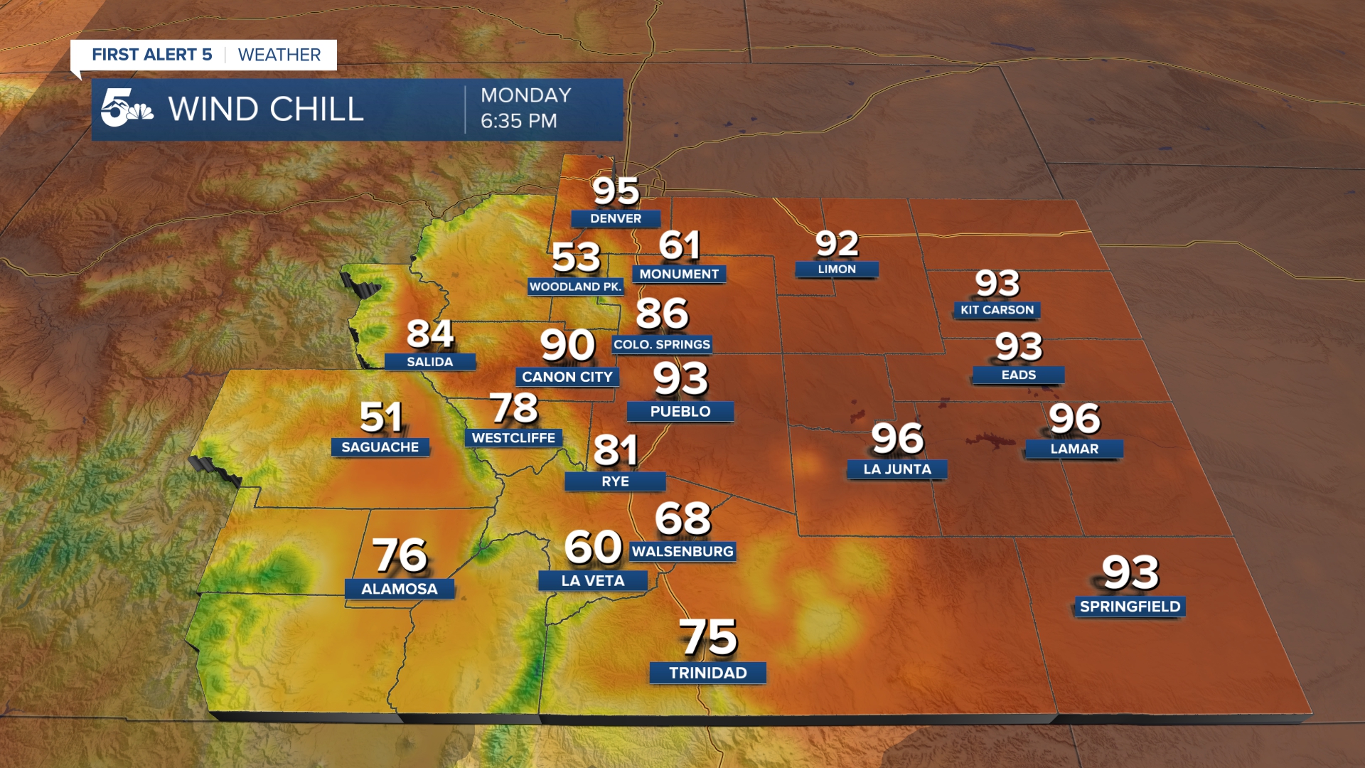
We are not expecting much of a temperature improvement throughout the day. Highs will likely stay near or below zero from Denver through Pueblo along I-25 and most towns east of the interstate.
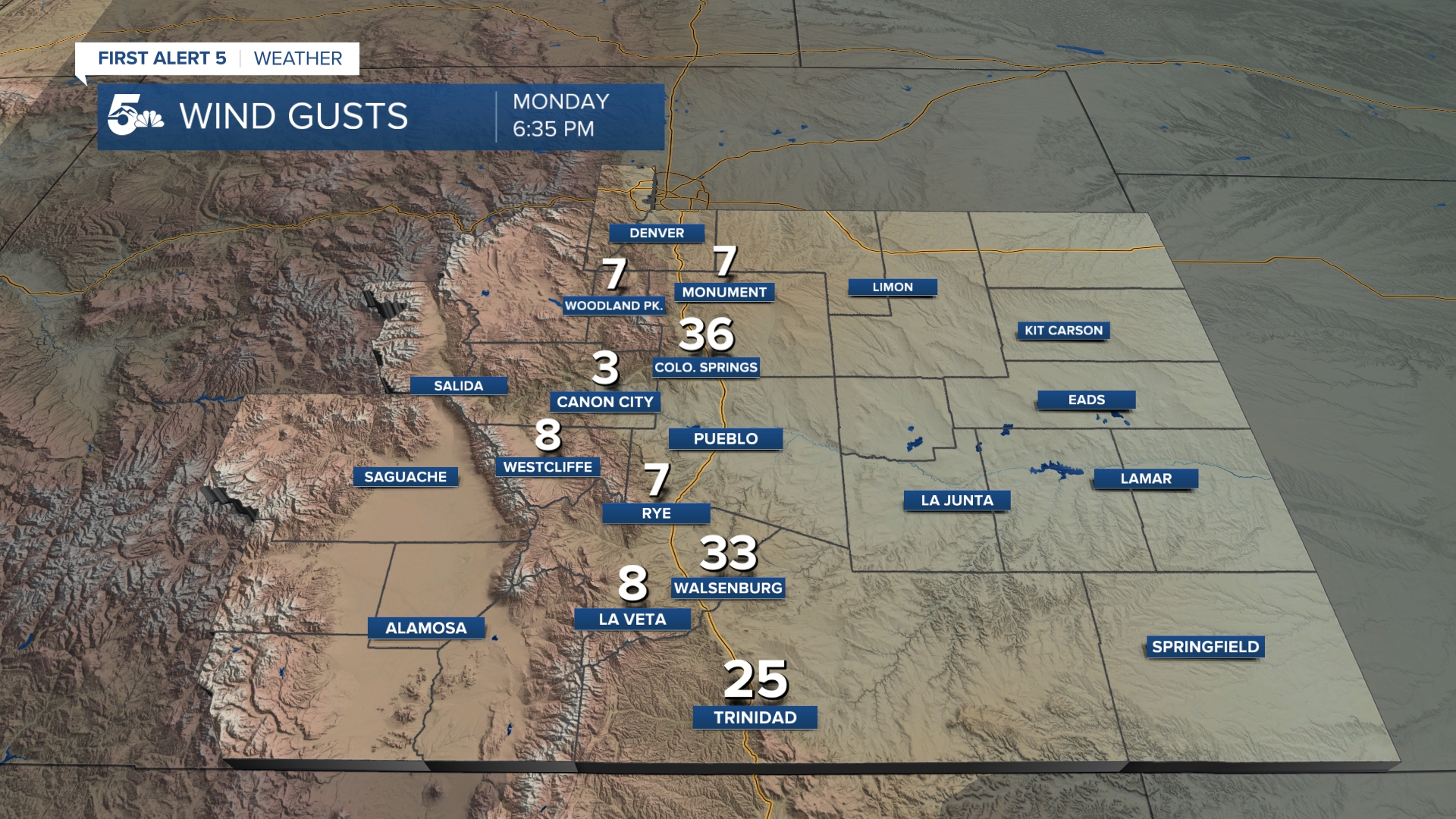
Blizzard-like driving conditions have impacted roads in northern Colorado, west along the I-70 corridor to Silverthorne, and south along I-25 from Denver through Colorado Springs.
Driving is not recommended AT ALL this morning due to snow-covered roads and less than a mile of visibility.
Snow is expected to stop falling through mid-morning, but the roads will remain snow-covered all day due to the arctic air temperatures.
Denver International Airport Delays/Cancellations:
As of 5:30 AM, DIA is reporting around 60 delays and 300 cancellations. This data comes from Flight Aware.
- Keep track of flight delays at Denver International Airportor the Colorado Springs Airport
In Case of Accident Alert Status:
This means that in the case of a traffic accident, all parties involved should agree to exchange information and report the accident individually if:
- No one was injured or died.
- Drugs and alcohol are not suspected as factors in the crash.
- The wreck didn’t damage any public property, like road signs, utility poles, or guard rails.
- It was not a hit and run.
If any of those factors are applicable to the situation, law enforcement should be contacted.
Resources:
- Get your latest First Alert 5 Weather Forecast
- Find the current school closing and delay list
- Watch KOAA News5 LIVE newscasts and updated content throughout the day in your browser, the News5 App, or your favorite streaming device.
- Download the free News5 App for your iOS or Android device to get the latest headlines and news across Colorado.
- Download the free First Alert 5 Weather App for your iOS or Android device to get the latest headlines and news across Colorado.
- You can find us on social media with KOAA on Youtube, Facebook, Instagram, and Twitter
