

Tonight's Forecast:
Areas of fog will develop in the eastern plains of Colorado tonight and sneak up along the Arkansas River as well.
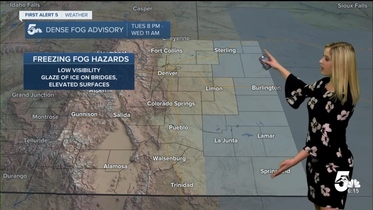
A dense fog advisory has been issued in the counties highlighted below, it will go into effect at 8 pm and last until Wednesday at 11 am. Freezing fog will bring low visibility and a glaze of ice on elevated surfaces.

Colorado Springs forecast: Low: 25; High: 52;
Partly cloudy with E wind at 5-10 mph. Temperatures will be about 5 degrees above average.
Pueblo forecast: Low: 23; High: 51;
Mostly cloudy on Wednesday with E wind at 2-8 mph.
Canon City forecast: Low: 29; High: 52;
Partly cloudy on Wednesday with S wind at 5-10 mph.
Woodland Park forecast: Low: 20; High: 40;
Partly cloudy on Wednesday with a few stray flurries possible in the afternoon. Winds will be from the NNW at 5-10 mph.
Tri-Lakes forecast: Low: 25; High: 48;
Partly cloudy on Wednesday with an isolated light shower possible in the afternoon. Otherwise, very light winds and pleasant temperatures.
Plains forecast: Low: 20s; High: 40s;
Another day with stubborn fog. A dense fog advisory is in effect until 11 am, and the sky will be mostly cloudy or overcast during the latter half of the day. High temperatures will barely make it to the low 40s.
Walsenburg and Trinidad forecast: Low: 27/27; High: 48/51;
Partly cloudy on Wednesday with a stray light shower possible in the afternoon. Otherwise, winds will be light and temperatures will be mild.
Mountains forecast: Low: teens/20s; High: 40s;
Partly to mostly cloudy with isolated light snow showers possible with little to no accumulation in the valleys. Temperatures will be mild with highs in the low 40s.
Extended outlook forecast:
On Thursday, widespread snow returns to the mountains, west of the continental divide during the day then moves east of the divide in the evening. Thursday night into Friday, a mix of rain and snow is possible for I-25 and the SE plains, favoring areas south of the Arkansas River. We will have breezy and cool northerly winds on Friday, but this storm will not be incredibly cold with highs expected to be above freezing in the 30s and 40s.
Expect a warming trend over the weekend with 40s in the mountains and 50s in the plains. That warmth lingers into early next week.
____
Curious about the First Alert 5 Weather Storm Impact Scale? Check out our cheatsheet explainer.
Watch KOAA News5 on your time, anytime with our free streaming app available for your Roku, FireTV, AppleTV and Android TV. Just search KOAA News5, download and start watching.
