Tremendous snowfall last week over central and western Colorado brought incredible moisture to drought-stricken parts of the state.
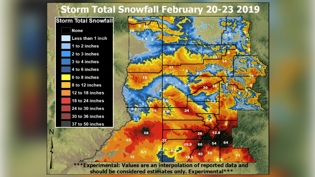
From Feb. 20 to Feb. 23, more than 3 feet of snow fell across the San Juan mountains, with well over a foot along portions of the US 160 corridor.
Many highways in southeast Utah and southwest Colorado were closed for a period of time on Feb. 22 when snow rates were at their highest. Mountain passes in the San Juans were closed due to avalanche concerns, and avalanche warnings were issued in the La Sal, Abajo and San Juan mountains.
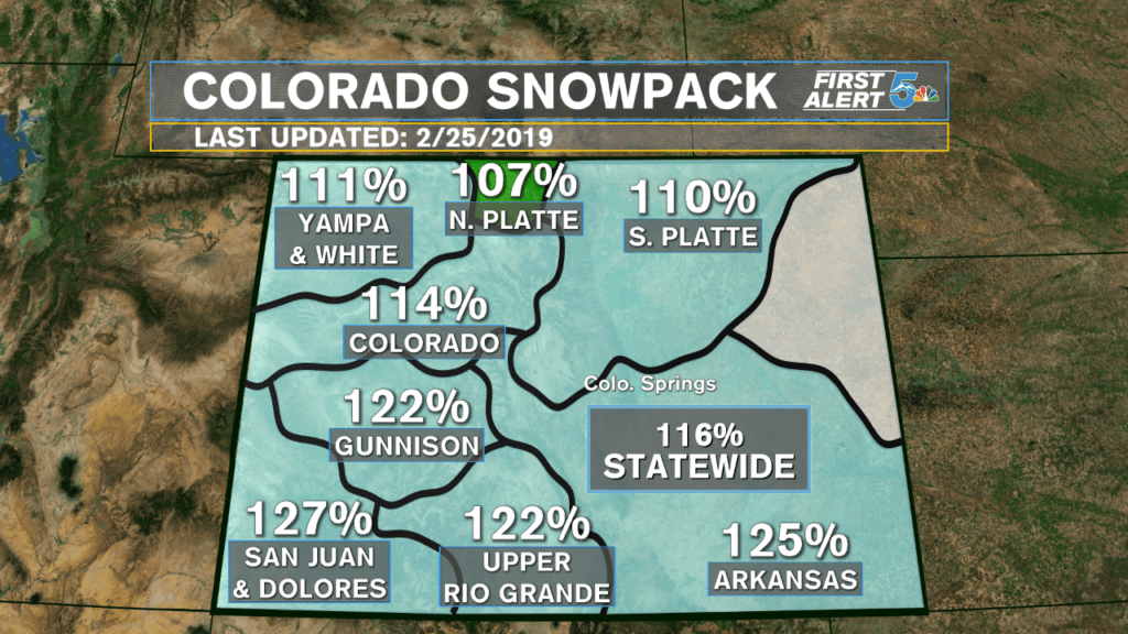
This snow proceeded to bring the Gunnison, San Juan/Dolores and Upper Rio Grande river basins to some of the highest snowpack levels in the last two years. This snow, along with additional snows since the beginning of February, have cut “extreme” drought levels in half.
Drought monitor reports at the beginning of February showed over 20 percent of the state covered in extreme drought, but as of now, only 10 percent of the state remains under extreme drought
