When snow falls, the temperature where it forms, dictates the shape it takes. It takes a shape most efficient with regards to the temperature. As it falls, it may encounter a wide variety of temps on it’s way down. The air temp may help keep it frozen, or melt it.
(There’s even more going on than you realize, because the first snowflakes themselves, falling through the initially dry air, are melting, evaporating, and thus, cooling that air they fall through, cooling it several degrees before the air is saturated. Which is why it can snow even though the air temperature may be over 40F…but that’s another story to come.)
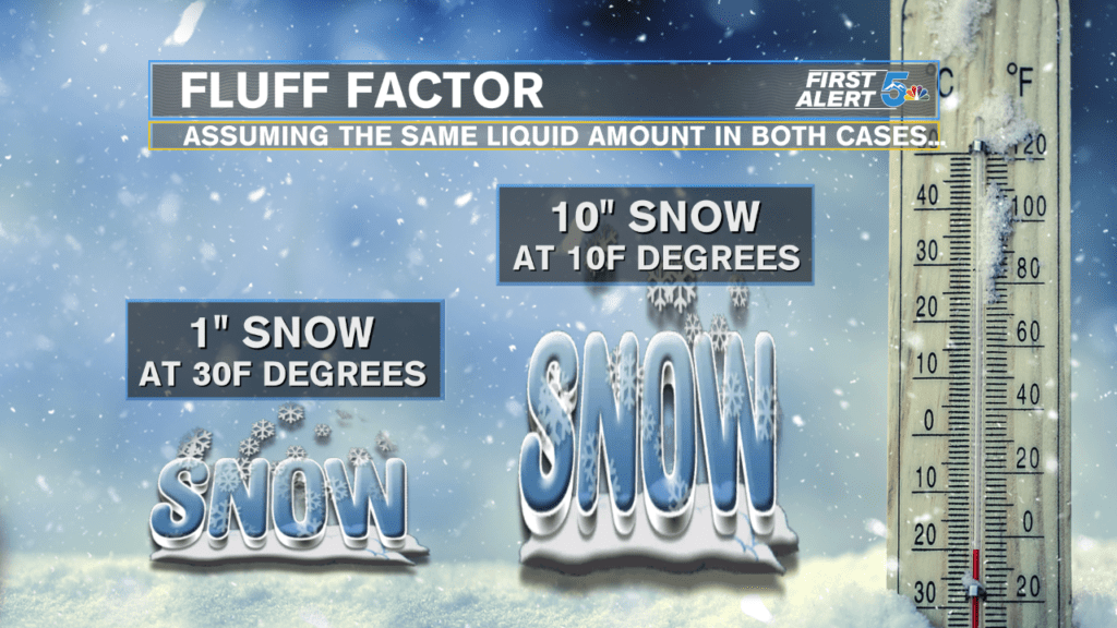
But back to temps, the colder that the air the snow forms in, the smaller the crystals, and therefore…the lighter or “fluffier” they are. The closer to 32F that snow forms, it forms larger and “wetter”, since it may or may not begin melting at a moment’s notice around 32F. In addition, the “wetter” the snow, the quicker it sticks, since water sticks or absorbs into many things…whereas lighter, fluffier snow is more apt to be blown about.
At this point, it should begin occurring to the reader, how much is going on in the Meteorologist’s mind, during snow events! We have to determine when and where the parent storm is going, when it will arrive, and depart. How intense it will be. How cold it will be…at onset…mid and end points of the storm, for a huge geographical area (13 counties, in our case!) Will there be multiple precipitation types, and if so, for whom and when? And then, communicate the time, intensity, precipitation types, accumulations, fluff factor, etc, throughout the event!
