Two years ago on August 6th, 2018, a massive hail storm pummeled El Paso County.
Let's look back at how this storm formed and just how bad the damage was.
Weather Set Up:
August 6th, 2018 was a classic Front Range hail day. Severe weather ingredients were in place and lined up just right for explosive thunderstorms.
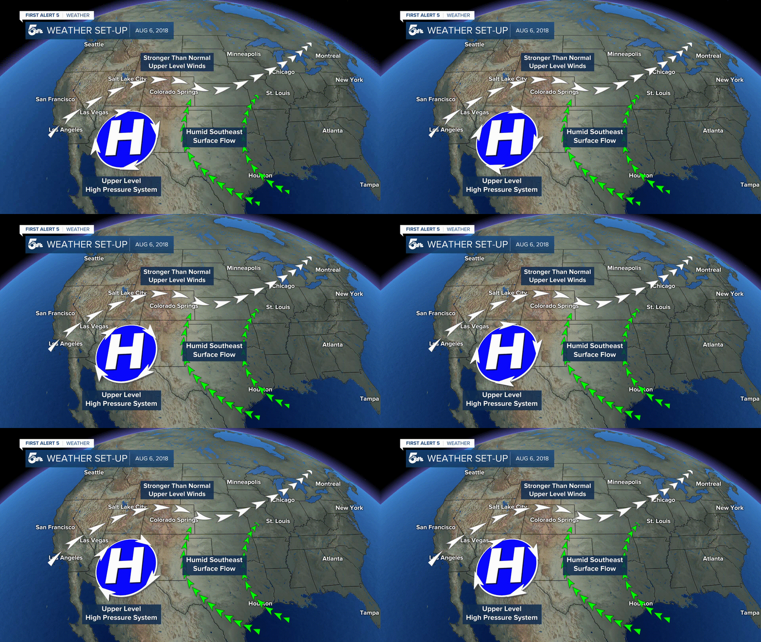
Colorado was under a general monsoon pattern with an upper level high pressure system and moist southeast surface flow feeding into the state.
Normally in a monsoon set up, wind shear is low because jet stream winds over Colorado tend to be weak. August 6th was unique and had stronger than normal jet stream winds which lead to strong wind shear across the region.

The Storm Prediction Center had issued a marginal to slight risk across southern Colorado, including El Paso County.
For you weather nerds out there, the pre-storm environment in El Paso County had surface dew points of 58°, 2000 J/kg mixed layer CAPE, and 45-50 knots effective bulk wind shear.
All these ingredients allowed storms to grown strong as they approached Teller County, and explode as they entered El Paso County.
Storm Evolution:
Storms started over Park County, quickly growing and turning severe as they moved into Teller County.
Two storms were given a Severe Thunderstorm Warning at 1:19 and 1:45pm. The second and stronger of the two storms split south and moved along highway 24 into El Paso County.

The severe thunderstorm moved over the Cheyenne Mountain Zoo at 2 pm, dropping radar estimated 2 to 2.5 inch hail.

Storm reports later collected by the National Weather Service confirm hail approximately 2.75" in diameter fell over the zoo.
The supercell continued to move southeasterly into the Broadmoor Bluffs, Security, Fort Carson, eventually over the town of Fountain, where 2.5” diameter hail was observed.
Remember the hail storm from August 6th, 2018 that slammed into Colorado Springs and the Cheyenne Mountain Zoo? 📷Blake Furman - Fort Carson pic.twitter.com/NWUk1n0MAo
— Sam Schreier (@SamASchreier) August 4, 2020
Hundreds of photos and videos of hail, such as the video above at Fort Carson, were shared as the storm barreled through El Paso County.
**MUST WATCH**
— Live Storm Chasers (@Livestormchaser) August 7, 2018
WOW...
Deadly Hail Impacts Cheyenne Mountain Zoo in Colorado Springs, CO today! Up to 4 inch hail impacted the area. Watch what happens...
This was the Grizzly Exhibit...#COwx #StormHour @StormHour pic.twitter.com/J7ZGEEWW6n
People at the Cheyenne Mountain zoo scrambled to find cover, and zoo keepers even risked their own safety trying to save what animals they could.
The video above shows 2 to 3 inch hail falling in the grizzly bear enclosure as they bears run around confused, trying to find cover.
The Aftermath:
People were hurt, cars totaled, houses damaged, animals killed, and millions of dollars were lost from this historic hail storm.
Fourteen people were hurt and five animals were killed at the Cheyenne Mountain Zoo.
The video above shows the extent of the damage at the Cheyenne Mountain Zoo from aerial footage.
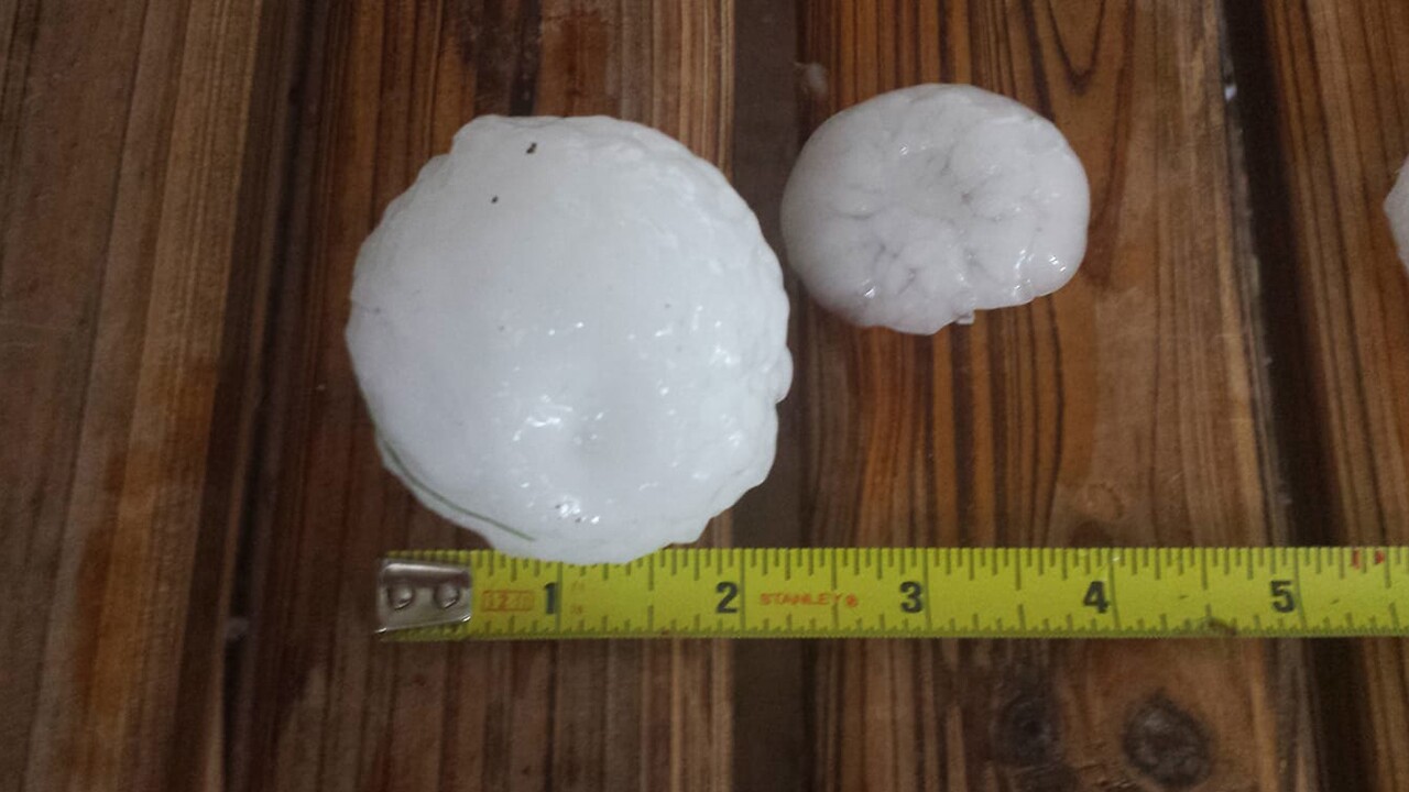
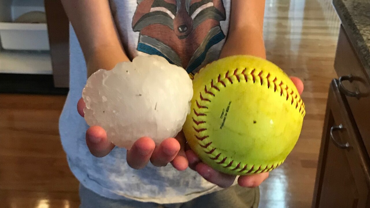
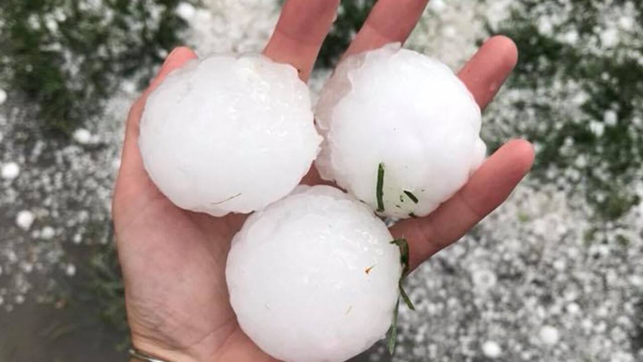
Hail sizes ranged from dimes all the way up to tennis, baseball, and nearly softball-sized stones.
The largest hailstone reported from this storm was in Security with a whopping 4 inches in diameter, the size of a softball.
According to the Rocky Mountain Insurance Information Association, the cost of this storm was an estimated $172.8 million in insured damages.
21,000 car insurance claims were filed, resulting in more than $126.3 million and 6,000 property insurance claims added up to more than $46.5 million.
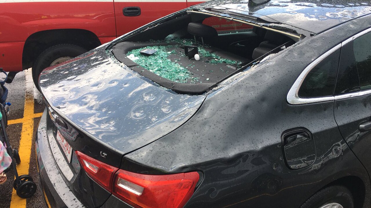
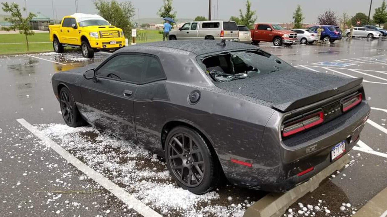
Vehicle damage was extensive across the Pikes Peak Region, with 400 cars alone in the zoo parking lot sustaining severe damage.
Many had car windows punctured or completely blown out with large dents across the entire car.
Many homes across the region, especially around the Security,Broadmoor Bluffs, and Fountain area, saw extensive roof, siding, and window damage.

Statistically, hail season tends to peak in June and July, and start to wind down in August.
The August 6th storm in 2018 was a great example of how even late in the severe weather season, Front Range storms can quickly become strong to severe.
As always, follow the KOAA First Alert 5 Storm Team for forecast and storm updates.


