Frodo said it best: "It's over, it's done."
The Climate Prediction Center has issued the final La Niña advisory, signaling an end to this phase of ENSO.
Why it Matters:
- La Niña is associated with heat and drought across the southern United States
- Years of persistent drought and overuse have depleted water across the desert southwest
- Colorado has a stronger association with La Niña than El Niño

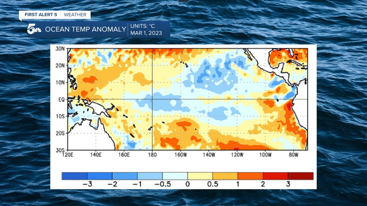
La Niña is characterized as colder than normal water temperatures in the eastern Pacific.
The picture above represents sea surface temperature anomalies measured on March 1st.
As temperature anomalies at the equator warm above zero, La Niña ends and an ENSO neutral phase begins.

Colorado has a stronger relationship with La Niña than El Niño, especially in the cold months.
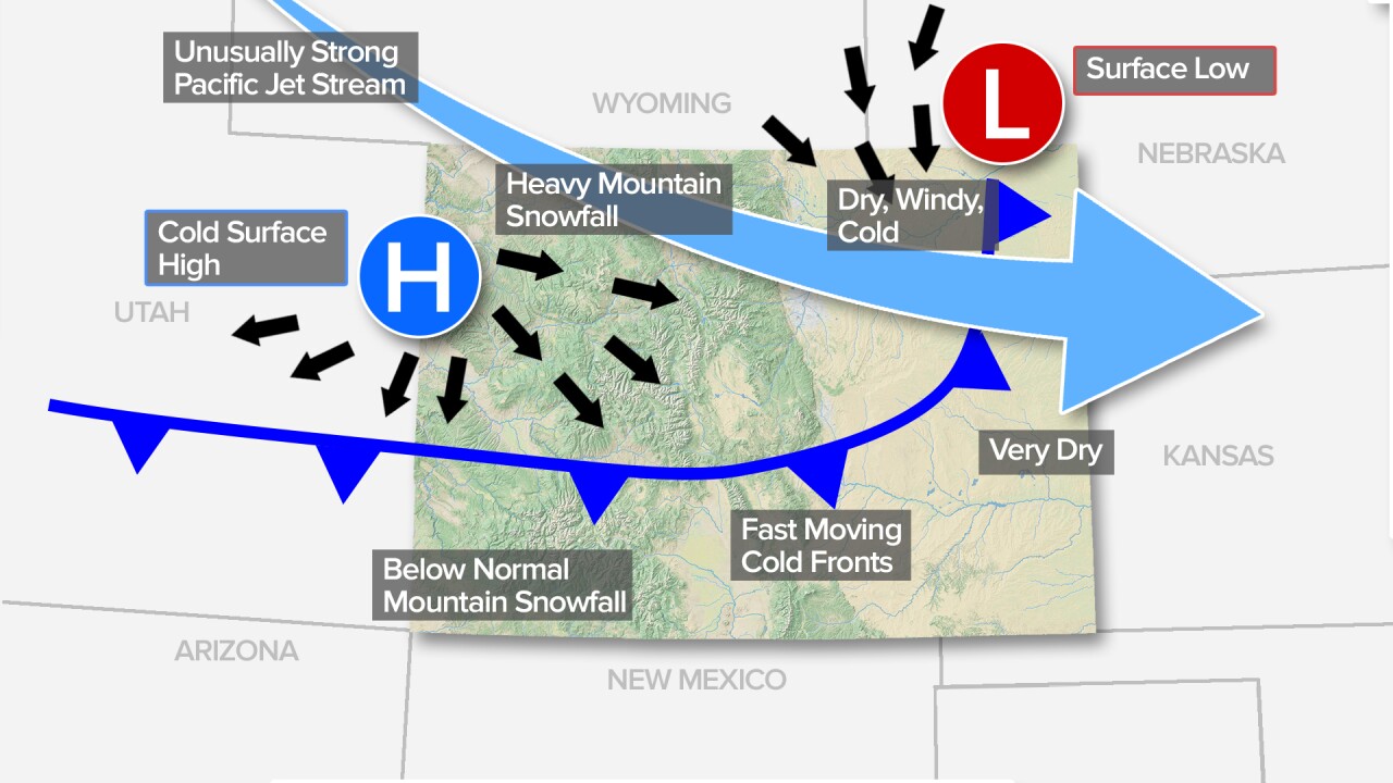
Winters during La Niña in Colorado tend to be windy and dry across the plains with heavy snow across the northern Continental Divide.

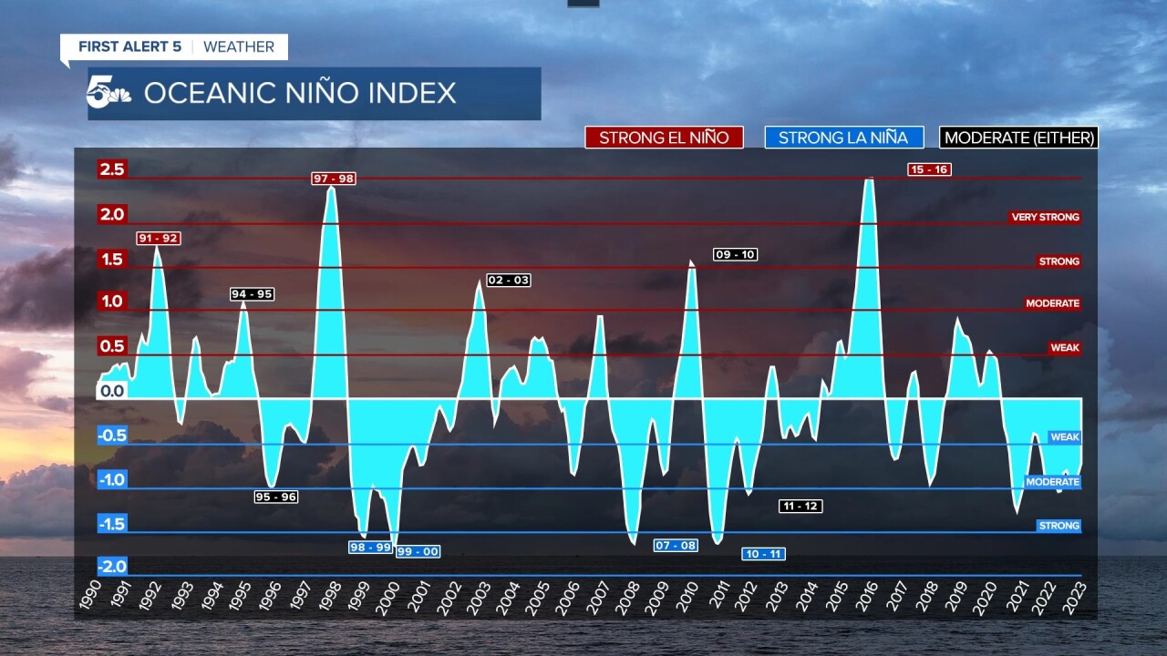
Over the past three years, La Niña has been the observed ENSO phase.
This "triple dip" event is partially responsible for lower than normal snowfall across Colorado, Utah, and California in the winter, drought through the summer, and massive wildfires through the Fall.
What does this mean for Summer?
ENSO neutral conditions are expected to continue through the Spring and early Summer.

ENSO neutral is defined as a period where neither El Niño or La Niña is present.
There is no strong correlation between ENSO neutral conditions and atmospheric weather patterns, especially here in Colorado.
Hopefully, this will lead to average precipitation through the Spring and Summer with little to no effect on the monsoon season.
Neutral conditions are forecast to continue through early Summer with probabilities dropping below 50% after August.

At the moment, El Niño conditions are forecast with around 60% certainty from late Fall through early Winter.
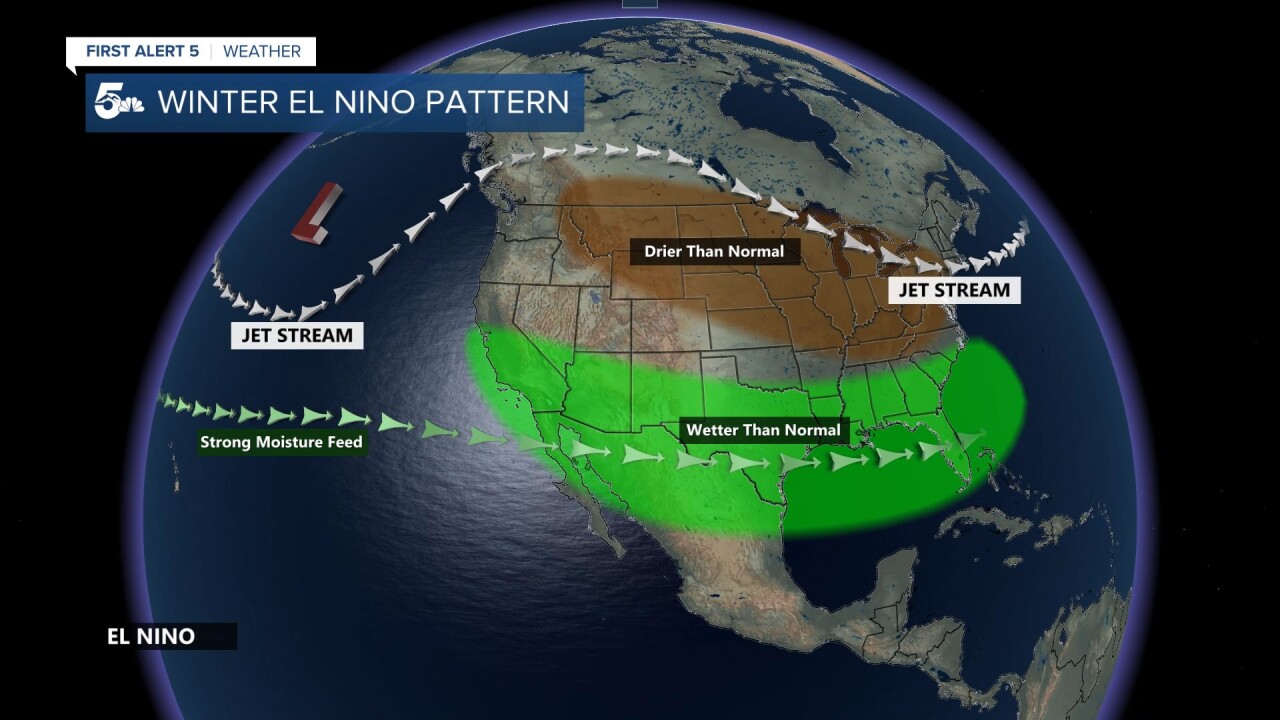
While El Niño correlates to wetter than normal conditions across the southern United States, the same does not always apply to Colorado.
According to the Colorado Climate Center, there is a stronger relationship between El Niño and temperatures in our state compared to precipitation.
"For Colorado, you may notice that the strongest signal shows up in wintertime temperature anomalies during an El Niño, when the entire state is likely to experience overall below-average temperatures. During a La Niña, the eastern plains are more likely to see above-average temperatures in the winter and summer.
When looking at precipitation, there's even more uncertainty! The most dominant signal shows up during La Niña summers. At that time, much of Colorado has tended to experience slightly below average precipitation."
_____
Watch KOAA News5 on your time, anytime with our free streaming app available for your Roku, FireTV, AppleTV and Android TV. Just search KOAA News5, download and start watching.


