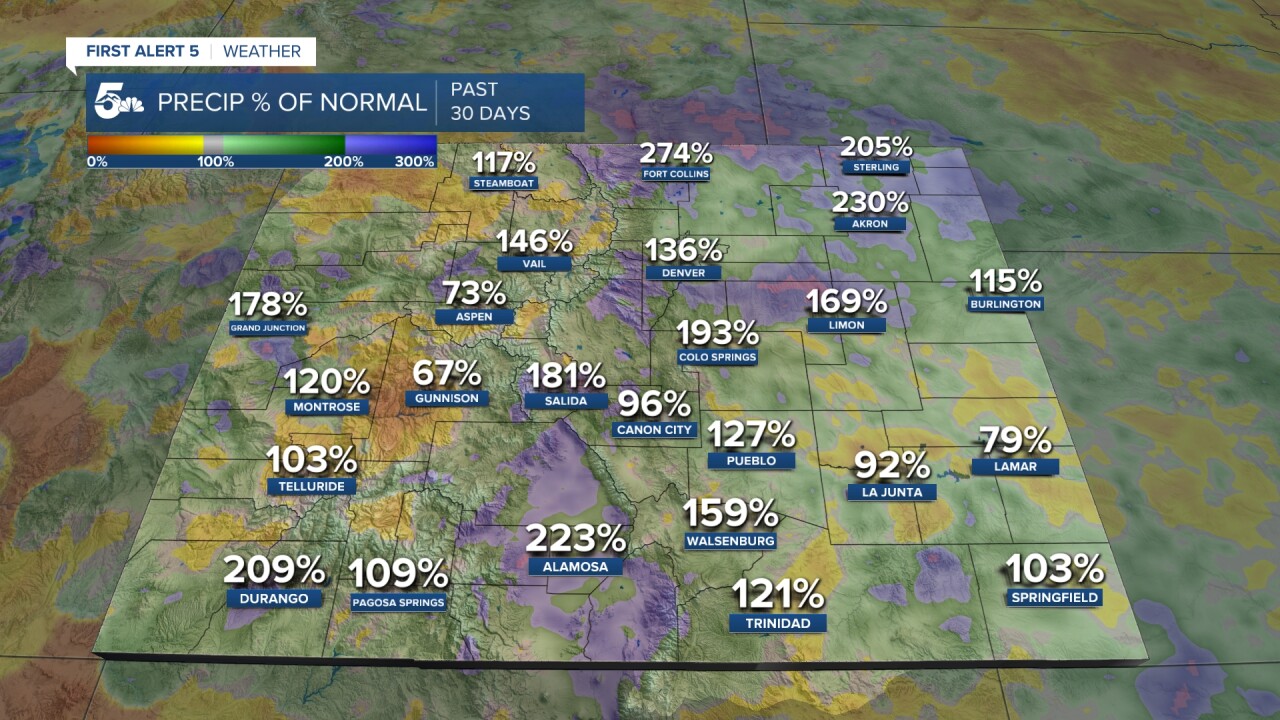
Midway through the month of August, and so far Mother Nature has been pretty good to us. Thanks to a noticeable uptick in monsoonal moisture, many areas in the state are running above average for the past 30 days, including parts of Southern Colorado.

In spite of weeks of rain, the overall picture remains drier than average this summer so far in Colorado Springs, with slightly above normal rainfall for Pueblo. Keep in mind that the official reporting stations for both areas can be found at the airport, and precipitation does not fall uniformly across an area.

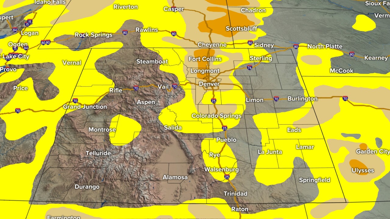
This week's drought report shows that only around 34% of the state is drought free. Areas of moderate drought have expanded this month along the Palmer Divide, extending southward into central parts of El Paso and Teller counties.
The worst of the drought statewide can now be seen up to our north. Parts of Boulder County, where the fatal Stone Canyon blaze burned in late July, are now under extreme drought.
Abnormally dry conditions seen in yellow have also expanded on the High Plains and over the western half of the state this month.

These droughts updates are released weekly at https://droughtmonitor.unl.edu/.
In looking back at the drought monitor that was issued on August 1, 2024, we were in a much better place. As we started the month, nearly 60% of the state was drought free, and there were no areas of extreme drought.

In the short term, the monsoon flow will get cut off from the state, resulting in drier weather through the weekend. Mountain showers will be possible by Sunday, with showers expected to return to the I-25 corridor and Plains by early next week.


