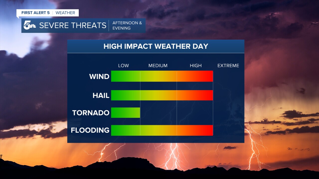
Severe weather impacted southern Colorado Wednesday.
6:25 p.m. Severe Thunderstorm Warning remains in effect across parts of Crowley, Otero, Bent and Kiowa counties until 6:45 p.m. Main threats will be nickle size hail and 60 mph wind gusts.
5:18 p.m. Most of the severe weather over the I-25 corridor is winding down. Still some heavy rain on the south side of Pueblo. Now the Plains will see the biggest threat as storms move east over the next 3-4 hours. Heavy rain, lightning, large hail and flooding main threats.
4:39 p.m. Tornado warned storm just east of the Hanover area appears to be weakening. The storm is moving off to the SE at 20 mph, with tennis-ball-sized hail and a possible tornado. Seek shelter in your tornado safe space if you live in this area of southeast El Paso County and northeastern Pueblo County.
3:57 p.m. Security floodwaters are now receding, as the worst of the weather is pushing farther south. Up next...Pueblo:
“It’s much better than earlier, it’s the worst I’ve ever seen.” A resident of Security told me. #cowx this is on Main St @KOAA @AlanRoseWX pic.twitter.com/7ixqdbVsRn
— Alex O'Brien (@WXAlexOBrien) July 15, 2020
3:35 p.m. Seeing a lot of reports of hail and flooding out towards Security:
Penny and nickel sized hail left on the ground on the north side of Security #COwx @KOAA @AlanRoseWX pic.twitter.com/2hkHNcdZYZ
— Alex O'Brien (@WXAlexOBrien) July 15, 2020
2:58 p.m. Numerous severe weather warnings in place right now across the Pikes Peak Region:
Right now in the Pikes Peak Region, we have 5 Severe Thunderstorm Warnings and 2 Flash Flood Warnings in place. Dangerous weather all around Colorado Springs. Stay home, stay safe and be weather ready! #cowx pic.twitter.com/FUDRwIZZPu
— Alan Rose (@AlanRoseWX) July 15, 2020
2:22 p.m. Flash Flood Warning issued for southeastern Colorado Springs, Fountain, Security, Widefield, Fort Carson and Stratmoor areas:
Due to slow moving storms over southwestern El Paso County, a Flash Flood Warning has been issued. This includes the Security and Widefield areas until 5:15 pm. Flooding of urban and low lying areas likely. #cowx pic.twitter.com/0TqNyifcBQ
— Alan Rose (@AlanRoseWX) July 15, 2020
1:31 p.m. Severe Storm warning issued
Severe Thunderstorm Warning for this cell east of Fountain pic.twitter.com/gIP8hHIxQc
— Sam Schreier (@SamASchreier) July 15, 2020
1:15 p.m. Storms getting stronger south of Colorado Springs:
Alright storms are quickly gaining strength along a boundary just south of Colorado Springs but right near Fountain. We'll have to watch these guys pretty carefully, but more storms coming out of the mountains later could be bad over the Springs pic.twitter.com/8qvywXa4El
— Sam Schreier (@SamASchreier) July 15, 2020
Strong updrafts looking SE from Marksheffel and HWY 24 #COwx @KOAA @AlanRoseWX @SamASchreier pic.twitter.com/3EUeKwzEz9
— Alex O'Brien (@WXAlexOBrien) July 15, 2020
12:52 p.m. Storm clouds forming near Colorado Springs:
Watching towers go up SE from the east side of Colorado Springs. #COwx @KOAA @SamASchreier @AlanRoseWX pic.twitter.com/dLMt8XnjMR
— Alex O'Brien (@WXAlexOBrien) July 15, 2020
11 a.m. General storm expectations for this afternoon:

Storms will begin to develop in and around the mountains shortly after lunchtime and spread east into the lower elevations this afternoon.

As storms leave the mountains, they are expected to grow strong and likely severe, with nearly all modes of severe weather likely.
Large hail, flooding, and strong winds remain our primary weather threats later today, but an isolated tornado in the plains is still a small possibility.
KOAA Facebook / KOAA Twitter / KOAA_5 Instagram
Latest First Alert 5 Weather Forecast
Watch News5 LIVE newscasts
Download the News5 App
Download the First Alert 5 Weather App


