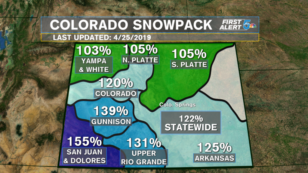
Healthy snowfall from November through April has not only erased the crippling drought across Colorado, but it’s also kept our snowpack at the highest level we’ve seen in two years!
To have every basin in Colorado at 100% or greater for snowpack this late in the Spring is incredible, not only for the ski resorts but for the water supply and the health of Colorado’s forests. 2018’s winter season was so weak, that our snowpack levels are just over DOUBLE what we had last year.
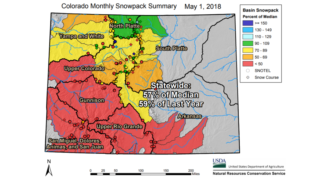
Archived Snotel data is a bit harder to read, but the main thing to take away is 57% of the median. It means last year the statewide snowpack was roughly half of what is considered a normal level. The worst basins were by far Upper Colorado through the Rio Grande and San Juan, where snowpack levels were worst than 50 percent of the normal level.

The best effect of this stacked snowpack is, without a doubt, the impact it’s had on Colorado’s drought. As of now, the only sliver of drought left in the state is over Conejos County in far southern Colorado, and even then most of the county is fine. Grass fires will still be of major concern going forward, but with heavy snow still out in the mountains, widespread wildfire fears are considerably lower.
